Cof Cymru: National Historic Assets of Wales · Wales
Gatepiers and Gates to E of Stable Cottage Glanarberth
Llangoedmor, Ceredigion, Wales
A Grade II listed building in Llechryd, Llangoedmor, Ceredigion, designated on 16 April 1980.
The record
- Designation
- Listed building, Grade II
- Broad class
- Domestic
- Date of designation
- 16 April 1980
- Locality
- Llechryd
- Community
- Llangoedmor
- Unitary authority
- Ceredigion
- Country
- Wales
- Coordinates
- 52.06457, -4.59755
- Cadw reference
- 10695
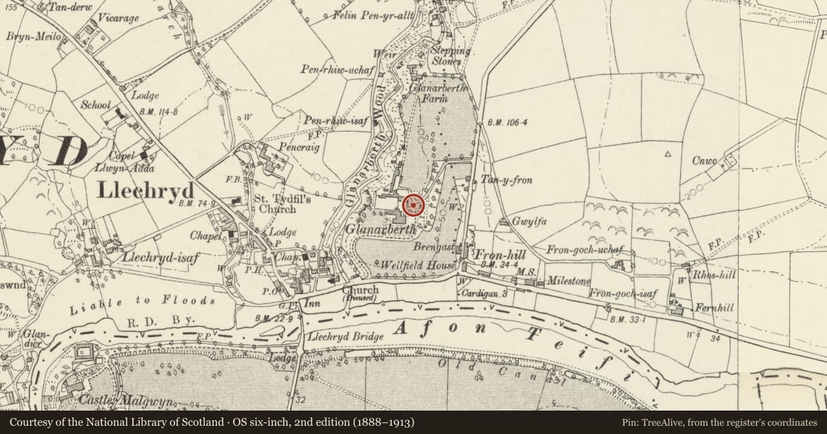
Slide toward Today to fade the historical sheet and see the modern map underneath.
David Rumsey Map Collection, Stanford LibrariesDavid Rumsey Map Collection, Stanford LibrariesDavid Rumsey Map Collection, Stanford LibrariesDavid Rumsey Map Collection, Stanford LibrariesDavid Rumsey Map Collection, Stanford Libraries
5 historical maps cover this location, the earliest the 1608 map "(13) Cambriae Typus." (David Rumsey Map Collection, Stanford Libraries).
Historical maps covering this location
- 1608 · (13) Cambriae Typus. (David Rumsey Map Collection, Stanford Libraries)
- 1636 · Cornubia : Devonia, Somersetus, Dorcestria, Wiltonia, Glocestria ... (David Rumsey Map Collection, Stanford Libraries)
- 1637 · Particular description of Wales. Cambria seu Wallia (David Rumsey Map Collection, Stanford Libraries)
- 1830 · V.3:11-15:XV. Britisches Reich. A. Kon: England. b. Frstenthum Wales: Shire: 37-40 (David Rumsey Map Collection, Stanford Libraries)
- 1899 · 194 Llangranog (Hills) (David Rumsey Map Collection, Stanford Libraries)
Cadw's description
Location
Situated just E of Stable Cottage, giving access to rear drive.
Exterior
Circa 1865 gatepiers and gates, two broad piers of coursed rubble stone with slate caps. Pair of iron gates with wrought-iron scrolled and twisted spearheads above top-rail ramped down to meeting-stile. Mid-height double rail with intersecting half-ovals between, dog-bars below and similar spearheads above. Four slate steps up bank in front of left pier.
Gates to rear drive from former Glanarberth mansion, demolished 1986. Mansion was built in early 1860s.
Reason for designation
Group value with other listed items in former Glanarberth estate.
Nearby in the register
- Stable cottage at Glanarbeth including attached range to NWDomesticunder 1 mi
- Tower E of Stable Cottage GlanarbethDomesticunder 1 mi
- Entrance Gates Piers and Railings at GlanarberthDomesticunder 1 mi
- DerwyddDomesticunder 1 mi
Other entries of the same register within about three miles of this one, by straight line.