Cof Cymru: National Historic Assets of Wales · Wales
Former Farmhouse at Penralltddu
Cilgerran, Pembrokeshire, Wales
A Grade II listed building in Llantood, Cilgerran, Pembrokeshire, designated on 15 April 1994.
The record
- Designation
- Listed building, Grade II
- Broad class
- Domestic
- Date of designation
- 15 April 1994
- Locality
- Llantood
- Community
- Cilgerran
- Unitary authority
- Pembrokeshire
- Country
- Wales
- Coordinates
- 52.05045, -4.66988
- Cadw reference
- 14521
Slide toward Today to fade the historical sheet and see the modern map underneath.
David Rumsey Map Collection, Stanford LibrariesDavid Rumsey Map Collection, Stanford LibrariesDavid Rumsey Map Collection, Stanford LibrariesDavid Rumsey Map Collection, Stanford LibrariesDavid Rumsey Map Collection, Stanford Libraries
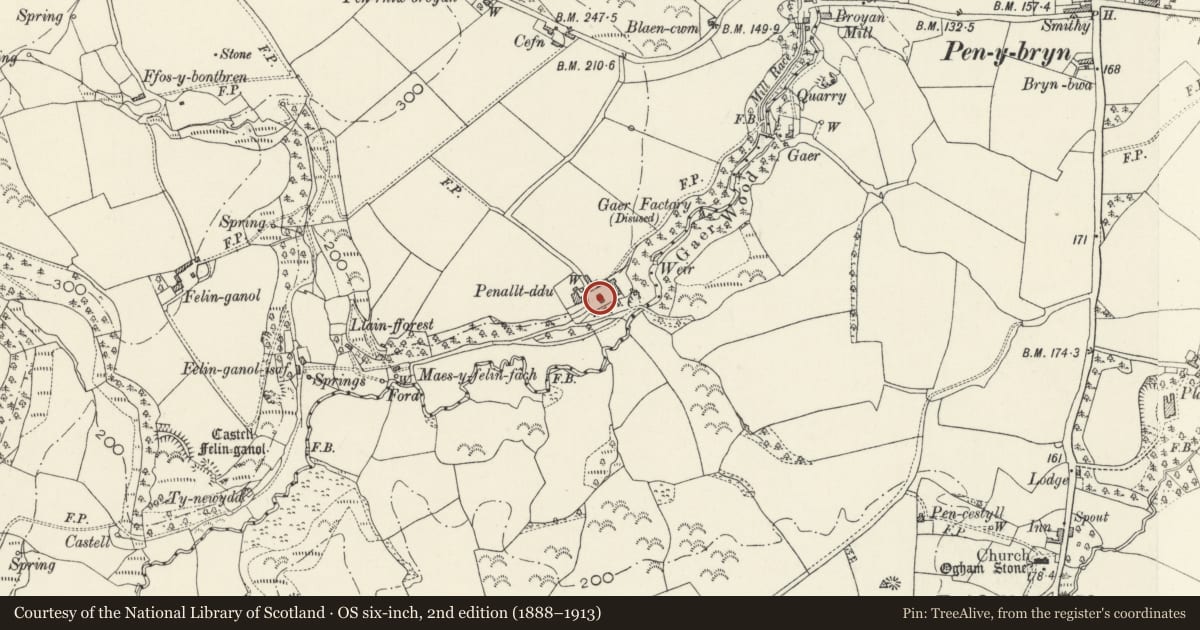
5 historical maps cover this location, the earliest the 1608 map "(13) Cambriae Typus." (David Rumsey Map Collection, Stanford Libraries).
Historical maps covering this location
- 1608 · (13) Cambriae Typus. (David Rumsey Map Collection, Stanford Libraries)
- 1830 · V.3:11-15:XV. Britisches Reich. A. Kon: England. b. Frstenthum Wales: Shire: 37-40 (David Rumsey Map Collection, Stanford Libraries)
- 1891 · Sheet 10. Ordnance Survey of England and Wales. . (David Rumsey Map Collection, Stanford Libraries)
- 1898 · 193 Cardigan (Hills) (David Rumsey Map Collection, Stanford Libraries)
- 1901 · Sheet 13. (David Rumsey Map Collection, Stanford Libraries)
Cadw's description
Location
Situated facing W, backing onto farmyard.
Exterior
1826 farmhouse converted to outbuilding after 1861, and incorporating datestones of an earlier building. Rubble stone with slate roof, no main chimneys and outshut rear with brick N end stack. Two-storey front, off-set to left, with three-window range of openings with cambered heads and stone voussoirs. Centre first floor window is blocked, centre ground floor window has been narrowed, first floor left window has been widened. Over the centre ground floor window is plaque 'T Bowen Esq/J Bowen M D /J W /1826', to left is plaque 'DW/JW 1803' and to right plaque 'WWE/JW 1773'. Each end has stone outside stairs to loft door. Interior has been remodelled as outbuilding, with C19 loft floor, no stairs and removed fireplaces. One fireplace with timber lintel in outshut.
Reason for designation
Penralltddu has an exceptional group of farm buildings with the 1861 farmhouse. This building is marked on the 1838 Tithe map as owned by TáBowen and J Bowen MD, occupied by W Williams.
Nearby in the register
- Outbuildings on E side of Farm Court at PenralltdduAgriculture and Subsistenceunder 1 mi
- Outbuilding on E side of drive at PenralltdduDomesticunder 1 mi
- PenralltdduDomesticunder 1 mi
- Outbuilding to rearof Farmhouse at PenralltdduDomesticunder 1 mi
Other entries of the same register within about three miles of this one, by straight line.