Cof Cymru: National Historic Assets of Wales · Wales
Penralltddu
Cilgerran, Pembrokeshire, Wales
A Grade II listed building in Llantood, Cilgerran, Pembrokeshire, designated on 15 April 1994.
The record
- Designation
- Listed building, Grade II
- Broad class
- Domestic
- Date of designation
- 15 April 1994
- Locality
- Llantood
- Community
- Cilgerran
- Unitary authority
- Pembrokeshire
- Country
- Wales
- Coordinates
- 52.05043, -4.67037
- Cadw reference
- 14519
Slide toward Today to fade the historical sheet and see the modern map underneath.
David Rumsey Map Collection, Stanford LibrariesDavid Rumsey Map Collection, Stanford LibrariesDavid Rumsey Map Collection, Stanford LibrariesDavid Rumsey Map Collection, Stanford LibrariesDavid Rumsey Map Collection, Stanford Libraries
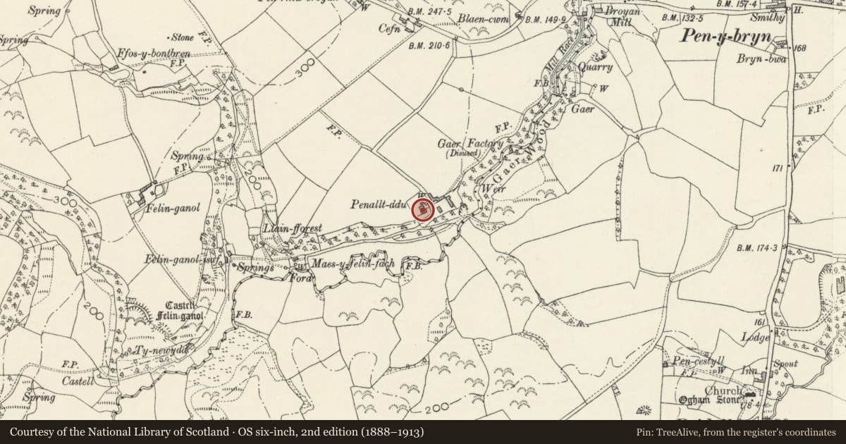
5 historical maps cover this location, the earliest the 1608 map "(13) Cambriae Typus." (David Rumsey Map Collection, Stanford Libraries).
Historical maps covering this location
- 1608 · (13) Cambriae Typus. (David Rumsey Map Collection, Stanford Libraries)
- 1830 · V.3:11-15:XV. Britisches Reich. A. Kon: England. b. Frstenthum Wales: Shire: 37-40 (David Rumsey Map Collection, Stanford Libraries)
- 1891 · Sheet 10. Ordnance Survey of England and Wales. . (David Rumsey Map Collection, Stanford Libraries)
- 1898 · 193 Cardigan (Hills) (David Rumsey Map Collection, Stanford Libraries)
- 1901 · Sheet 13. (David Rumsey Map Collection, Stanford Libraries)
Cadw's description
Location
Situated above Afon Piliau, approached by drive running S off minor road between A487 at Croft and Penybryn, some 1.5km E of Croft.
History
Dated 1861, large estate farmhouse built for J W Bowen.
Exterior
Grey squared stone with rockfaced quoins and yellow ashlar dressings. Slate eaves roofs with fretted bargeboards and paired end stone stacks. Two storeys, with large rear wing. Plinth with ashlar coping at ground floor sill level, ashlar moulded stringcourse. Windows with chamfered ashlar jambs, sandstone voussoirs and slate sills. Three window front with big gabled projecting centrepiece. Paired plate glass sashes. Centre has pointed arched entry with 'JWB 1861' on keystone, arched window to each side wall, panelled door within and radiating-bar fanlight, first floor paired sashes and attic pair of narrow vents. Left side facade is stuccoed, lined as ashlar, although the rest is of exposed stone. E end wall has single sash each floor and pair of vents in the gable. Rear wing has a very large end stack, E side big stair-light, door with traceried overlight, and paired sash each floor to right, the lower sashes 8-pane. W side is outshut with two-window range of 6-pane sashes.
Front garden is enclosed by spearhead iron railings on low brick wall coped in slate.
Reason for designation
Included as an unusually large and well-designed C19 farmhouse with extensive C19 outbuildings in an exceptional grouping.
Nearby in the register
- Outbuilding to rearof Farmhouse at PenralltdduDomesticunder 1 mi
- Outbuilding on E side of drive at PenralltdduDomesticunder 1 mi
- Former Farmhouse at PenralltdduDomesticunder 1 mi
- Outbuildings on E side of Farm Court at PenralltdduAgriculture and Subsistenceunder 1 mi
Other entries of the same register within about three miles of this one, by straight line.