Cof Cymru: National Historic Assets of Wales · Wales
White Horse Public House
Overton, Wrexham, Wales
A Grade II listed building in Overton, Wrexham, designated on 15 March 1994.
The record
- Designation
- Listed building, Grade II
- Broad class
- Commercial
- Date of designation
- 15 March 1994
- Locality
- Overton
- Community
- Overton
- Unitary authority
- Wrexham
- Country
- Wales
- Coordinates
- 52.97074, -2.93478
- Cadw reference
- 14438
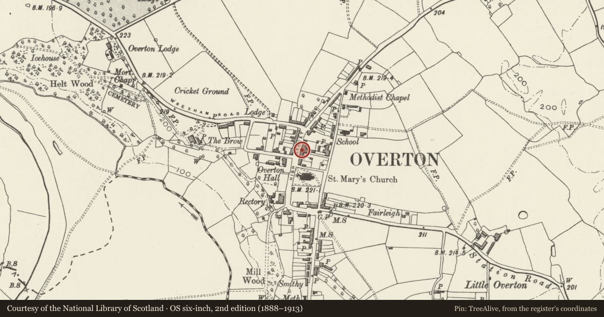
Slide toward Today to fade the historical sheet and see the modern map underneath.
David Rumsey Map Collection, Stanford LibrariesDavid Rumsey Map Collection, Stanford LibrariesDavid Rumsey Map Collection, Stanford LibrariesDavid Rumsey Map Collection, Stanford LibrariesDavid Rumsey Map Collection, Stanford Libraries
5 historical maps cover this location, the earliest the 1608 map "(13) Cambriae Typus." (David Rumsey Map Collection, Stanford Libraries).
Historical maps covering this location
- 1608 · (13) Cambriae Typus. (David Rumsey Map Collection, Stanford Libraries)
- 1637 · Particular description of Wales. Cambria seu Wallia (David Rumsey Map Collection, Stanford Libraries)
- 1830 · V.3:11-15:XV.Britisches Reich. A. Kon: England. a. England ab sich: Shire:15-17, 33 (David Rumsey Map Collection, Stanford Libraries)
- 1883 · Watershed map England, Wales 3. (David Rumsey Map Collection, Stanford Libraries)
- 1901 · Sheet 9 and 10. (David Rumsey Map Collection, Stanford Libraries)
Cadw's description
Location
Part of a continuous building line on High Street, between No.20 and Metcalfe Building.
History
An early C20 rebuilding of an earlier building, employing an neo-vernacular style.
Exterior
Ruabon brick with stone dressings to lower storey, mock timber framing above, in quatrefoil panels to first floor, and sunk quatrefoil panels to strongly jettied upper storey, the jetty carried on heavy brackets. Red plain tiled roof. Three-storeyed, wide 2-window range dominated by 2 gables and service wing to rear, with hipped roofs stepped down in height from the main range. Arched entrance to courtyard to left, with main entrance to public house alongside. Two paired mullioned and transomed windows to main bar. Bowed oriel windows in upper storey with leaded lights, and 6-light mullioned windows with leaded lights beneath gables in upper storey. Brick and terracotta end-wall stacks.
Reason for designation
A good example of early C20 neo-vernacular building, showing the use of a distinctive architectural style for a commercial building. Part of an important group of buildings on High Street.
Nearby in the register
- Metcalfe BuildingCommercialunder 1 mi
- Metcalfe BuildingCommercialunder 1 mi
- White CottageDomesticunder 1 mi
- 18 High StreetCommercialunder 1 mi
Other entries of the same register within about three miles of this one, by straight line.