Cof Cymru: National Historic Assets of Wales · Wales
Capel Brynseion
Cenarth, Carmarthenshire, Wales
A Grade II listed building in Pontseli, Cenarth, Carmarthenshire, designated on 2 March 1994.
The record
- Designation
- Listed building, Grade II
- Broad class
- Religious, Ritual and Funerary
- Date of designation
- 2 March 1994
- Locality
- Pontseli
- Community
- Cenarth
- Unitary authority
- Carmarthenshire
- Country
- Wales
- Coordinates
- 52.03083, -4.54602
- Cadw reference
- 14221
Slide toward Today to fade the historical sheet and see the modern map underneath.
David Rumsey Map Collection, Stanford LibrariesDavid Rumsey Map Collection, Stanford LibrariesDavid Rumsey Map Collection, Stanford LibrariesDavid Rumsey Map Collection, Stanford LibrariesDavid Rumsey Map Collection, Stanford Libraries
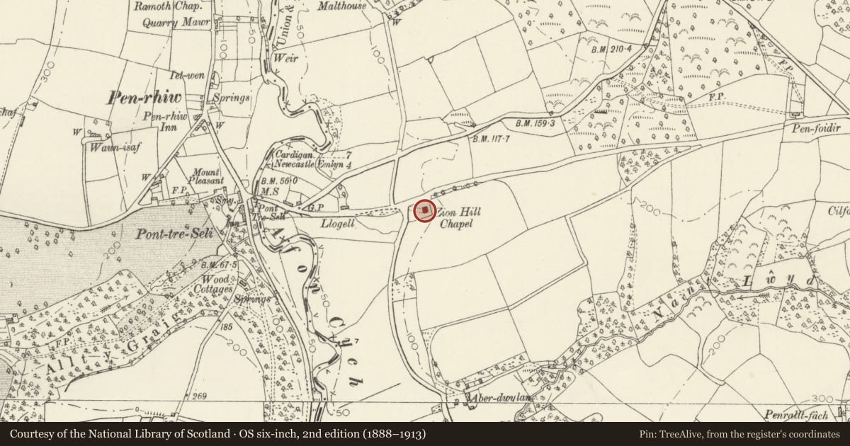
5 historical maps cover this location, the earliest the 1608 map "(13) Cambriae Typus." (David Rumsey Map Collection, Stanford Libraries).
Historical maps covering this location
- 1608 · (13) Cambriae Typus. (David Rumsey Map Collection, Stanford Libraries)
- 1830 · V.3:11-15:XV. Britisches Reich. A. Kon: England. b. Frstenthum Wales: Shire: 37-40 (David Rumsey Map Collection, Stanford Libraries)
- 1891 · Sheet 10. Ordnance Survey of England and Wales. . (David Rumsey Map Collection, Stanford Libraries)
- 1898 · 211 Newcastle Emlyn (Hills) (David Rumsey Map Collection, Stanford Libraries)
- 1901 · Sheet 14. (David Rumsey Map Collection, Stanford Libraries)
Cadw's description
Location
Situated some 400m E of Pont Treseli, up minor road.
History
This religious cause began at Cilfod Farm about 1804 as a Sunday School, preaching began there in 1810.
Exterior
1831 Independent Chapel, altered 1870. Rubble stone with slate eaves roof and crested ridge tiles. Bracketed eaves. Lateral facade of two large centre sashes with arched heads and plaque between 'Brynsion Adeladwyd 1831 Atgyweirwyd 1870', two broad camber headed doorways and two 6-pane outer gallery lights with cambered heads. Slate sills and cut stone voussoirs. Doors are 6-panel with matching 3-panel fixed side pieces. S end lean-to. N end 6-pane and 12-pane windows. One rear centre 12-pane window and two outer 6-pane gallery lights.
Interior
Three-sided gallery on four marbled columns, panelled timber gallery front. Raking box pews. Later C19 balustraded pulpit with curved front and steps up each side.
Nearby in the register
- Pont TreseliTransportunder 1 mi
- Ramoth Baptist ChurchReligious, Ritual and Funeraryunder 1 mi
- Outbuilding on E Side of Farmyard at GellidegAgriculture and Subsistenceunder 1 mi
- Range of outbuildings on W Side of Farmyard at GellidegAgriculture and Subsistenceunder 1 mi
Other entries of the same register within about three miles of this one, by straight line.