Cof Cymru: National Historic Assets of Wales · Wales
White House Cottage
Llandaff, Cardiff, Wales
A Grade II listed building in Llandaff, Cardiff, designated on 19 May 1975.
The record
- Designation
- Listed building, Grade II
- Broad class
- Domestic
- Date of designation
- 19 May 1975
- Locality
- Llandaff
- Town
- Cardiff
- Community
- Llandaff
- Unitary authority
- Cardiff
- Country
- Wales
- Coordinates
- 51.49493, -3.21792
- Cadw reference
- 13715
Slide toward Today to fade the historical sheet and see the modern map underneath.
David Rumsey Map Collection, Stanford LibrariesDavid Rumsey Map Collection, Stanford LibrariesDavid Rumsey Map Collection, Stanford LibrariesDavid Rumsey Map Collection, Stanford LibrariesDavid Rumsey Map Collection, Stanford Libraries
5 historical maps cover this location, the earliest the 1636 map "Cornubia : Devonia, Somersetus, Dorcestria, Wiltonia, Glocestria ..." (David Rumsey Map Collection, Stanford Libraries).
Historical maps covering this location
- 1636 · Cornubia : Devonia, Somersetus, Dorcestria, Wiltonia, Glocestria ... (David Rumsey Map Collection, Stanford Libraries)
- 1637 · The fourth table of England. Cornub. Devonia, Somerset etc. (David Rumsey Map Collection, Stanford Libraries)
- 1865 · England and Wales. England No. 6. (David Rumsey Map Collection, Stanford Libraries)
- 1898 · 263 Cardiff (Hills) (David Rumsey Map Collection, Stanford Libraries)
- 1913 · Sheet 110. Cardiff & Mouth of the Severn. (David Rumsey Map Collection, Stanford Libraries)
Cadw's description
Location
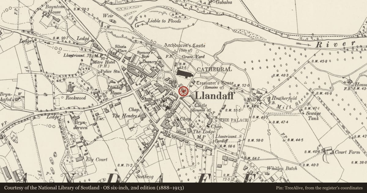
On the north-east side of The Cathedral Green and part of the important group of buildings surrounding it.
History
Probably C18 but may have some older fabric. John Speed's plan of 1610 shows a house on this site. The building was affected by the land mine which so badly damaged the Cathedral in January 1941 but the front elevation remains as it was before in appearance.
Exterior
The building is rendered, presumably over local rubblestone, with a Welsh slate gabled roof, rebuilt after bomb damage. Double depth central entrance plan. Two storeys with a three bay entrance front. Centre doorway with sloping hood on brackets, glazed door. Sash windows with glazing bars and horns, 6 over 6 panes. Gable stacks. Rear elevation with alterations since being damaged by bomb blast in 1941.
Interior
Interior not inspected at resurvey.
Reason for designation
Included as a largely C18 house and for its group value with the other listed buildings around The Cathedral Green.
Nearby in the register
- St. Teilo's WellWater Supply and Drainageunder 1 mi
- Garden Walls to White House CottageDomesticunder 1 mi
- No. 1 White HouseDomesticunder 1 mi
- No. 2 White HouseDomesticunder 1 mi
Other entries of the same register within about three miles of this one, by straight line.