Cof Cymru: National Historic Assets of Wales · Wales
No. 1 White House
Llandaff, Cardiff, Wales
A Grade II listed building in Llandaff, Cardiff, designated on 19 May 1975.
The record
- Designation
- Listed building, Grade II
- Broad class
- Domestic
- Date of designation
- 19 May 1975
- Locality
- Llandaff
- Town
- Cardiff
- Community
- Llandaff
- Unitary authority
- Cardiff
- Country
- Wales
- Coordinates
- 51.49510, -3.21803
- Cadw reference
- 13713
Slide toward Today to fade the historical sheet and see the modern map underneath.
David Rumsey Map Collection, Stanford LibrariesDavid Rumsey Map Collection, Stanford LibrariesDavid Rumsey Map Collection, Stanford LibrariesDavid Rumsey Map Collection, Stanford LibrariesDavid Rumsey Map Collection, Stanford Libraries
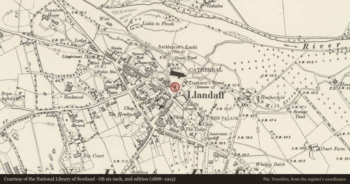
5 historical maps cover this location, the earliest the 1636 map "Cornubia : Devonia, Somersetus, Dorcestria, Wiltonia, Glocestria ..." (David Rumsey Map Collection, Stanford Libraries).
Historical maps covering this location
- 1636 · Cornubia : Devonia, Somersetus, Dorcestria, Wiltonia, Glocestria ... (David Rumsey Map Collection, Stanford Libraries)
- 1637 · The fourth table of England. Cornub. Devonia, Somerset etc. (David Rumsey Map Collection, Stanford Libraries)
- 1865 · England and Wales. England No. 6. (David Rumsey Map Collection, Stanford Libraries)
- 1898 · 263 Cardiff (Hills) (David Rumsey Map Collection, Stanford Libraries)
- 1913 · Sheet 110. Cardiff & Mouth of the Severn. (David Rumsey Map Collection, Stanford Libraries)
Cadw's description
Location
On the north-east side of The Cathedral Green and part of the important group of buildings surrounding it.
History
Late C18 in essence, but possibly containing older fabric, and altered post WWII, see above. John Speed indicates a building on the site in 1610.
Exterior
The right-hand house of a pair, see above. The house has two paired sashes towards the south end and with single sash over the centre doorway; the paired sashes are a post WWII alteration.
Interior
Interior not inspected at resurvey.
Reason for designation
Included as a largely C18 house and for its group value with the other listed buildings around The Cathedral Green.
Nearby in the register
- No. 2 White HouseDomesticunder 1 mi
- White House CottageDomesticunder 1 mi
- Garden Wall of Nos. 1 & 2 White HouseDomesticunder 1 mi
- Lychgate and attached wall descending to the CathedralReligious, Ritual and Funeraryunder 1 mi
Other entries of the same register within about three miles of this one, by straight line.