Cof Cymru: National Historic Assets of Wales · Wales
Old Rocket Station
Barry, Vale of Glamorgan, Wales
A Grade II listed building in The Knap, Barry, Vale of Glamorgan, designated on 7 February 1978.
The record
- Designation
- Listed building, Grade II
- Broad class
- Maritime
- Date of designation
- 7 February 1978
- Locality
- The Knap
- Community
- Barry
- Unitary authority
- Vale of Glamorgan
- Country
- Wales
- Coordinates
- 51.38883, -3.28973
- Cadw reference
- 13402
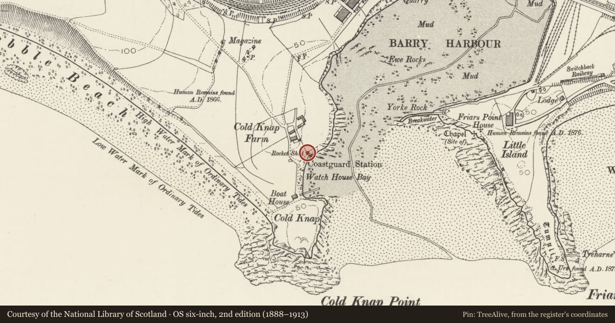
Slide toward Today to fade the historical sheet and see the modern map underneath.
David Rumsey Map Collection, Stanford LibrariesDavid Rumsey Map Collection, Stanford LibrariesDavid Rumsey Map Collection, Stanford LibrariesDavid Rumsey Map Collection, Stanford LibrariesDavid Rumsey Map Collection, Stanford Libraries
5 historical maps cover this location, the earliest the 1636 map "Cornubia : Devonia, Somersetus, Dorcestria, Wiltonia, Glocestria ..." (David Rumsey Map Collection, Stanford Libraries).
Historical maps covering this location
- 1636 · Cornubia : Devonia, Somersetus, Dorcestria, Wiltonia, Glocestria ... (David Rumsey Map Collection, Stanford Libraries)
- 1858 · 20. Bridgewater. (David Rumsey Map Collection, Stanford Libraries)
- 1865 · England and Wales. England No. 6. (David Rumsey Map Collection, Stanford Libraries)
- 1898 · 263 Cardiff (Hills) (David Rumsey Map Collection, Stanford Libraries)
- 1913 · Sheet 110. Cardiff & Mouth of the Severn. (David Rumsey Map Collection, Stanford Libraries)
Cadw's description
Location
Adjacent to watchtower for which it served as store for rocket apparatus.
History
Probably 1860s (contemporary with watchtower).
Exterior
One storey; walls in snecked stone. Slate gabled roof with coping and with chimney stack in N pitch. West elevation has broad camber-headed doorway with double boarded doors. South elevation with window; unfenestrated long elevation towards north.
Reason for designation
Included as surviving maritime structure from old port of Barry before developments of 1880's.
Group value with watchtower.
Nearby in the register
- WatchtowerMaritimeunder 1 mi
- Whitehouse CottageDomesticunder 1 mi
- Pavilions at Cold Knap Park with adjacent staircasesGardens, Parks and Urban Spacesunder 1 mi
- Knap Roman SiteVillaunder 1 mi
Other entries of the same register within about three miles of this one, by straight line.