Cof Cymru: National Historic Assets of Wales · Wales
Ogmore Vale Bakery
Cowbridge with Llanblethian, Vale of Glamorgan, Wales
A Grade II listed building in Cowbridge, Cowbridge with Llanblethian, Vale of Glamorgan, designated on 5 December 1963.
The record
- Designation
- Listed building, Grade II
- Broad class
- Commercial
- Date of designation
- 5 December 1963
- Locality
- Cowbridge
- Community
- Cowbridge with Llanblethian
- Unitary authority
- Vale of Glamorgan
- Country
- Wales
- Coordinates
- 51.46179, -3.44813
- Cadw reference
- 13220
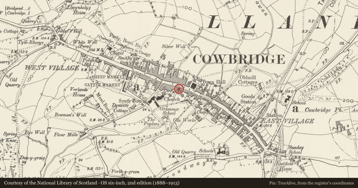
Slide toward Today to fade the historical sheet and see the modern map underneath.
David Rumsey Map Collection, Stanford LibrariesDavid Rumsey Map Collection, Stanford LibrariesDavid Rumsey Map Collection, Stanford LibrariesDavid Rumsey Map Collection, Stanford LibrariesDavid Rumsey Map Collection, Stanford Libraries
5 historical maps cover this location, the earliest the 1636 map "Cornubia : Devonia, Somersetus, Dorcestria, Wiltonia, Glocestria ..." (David Rumsey Map Collection, Stanford Libraries).
Historical maps covering this location
- 1636 · Cornubia : Devonia, Somersetus, Dorcestria, Wiltonia, Glocestria ... (David Rumsey Map Collection, Stanford Libraries)
- 1637 · The fourth table of England. Cornub. Devonia, Somerset etc. (David Rumsey Map Collection, Stanford Libraries)
- 1865 · England and Wales. England No. 6. (David Rumsey Map Collection, Stanford Libraries)
- 1897 · 262 Pontypridd (Hills) (David Rumsey Map Collection, Stanford Libraries)
- 1897 · 262 Pontypridd (Outline) (David Rumsey Map Collection, Stanford Libraries)
Cadw's description
Location
To L of Great House.
History
Early C19 probably.
Exterior
Three storeys. Two bay front elevation with pebbledash cladding with stuccoed dressings and slate roof. On ground floor, shop front in early C19 style, repaired or possibly re-fashioned in earlier C20; two small paned bow windows curve inwards to central recessed doorway in common frame with reeded pilasters with roundels in "capitals" and fascia with cornice. To right hand, round-headed doorway with fanlight with tracery and modern eight-panelled door. Twelve-pane sash windows on upper floors, smaller on top floor. Externally, stone blocks for second floor building extension at SE gable end.
Reason for designation
Early C19 building on prominent site in conservation area and group value with adjacent listed buildings.
Nearby in the register
- Principality Building SocietyCommercialunder 1 mi
- The Great HouseCommercialunder 1 mi
- 26Commercialunder 1 mi
- 22 High StreetCommercialunder 1 mi
Other entries of the same register within about three miles of this one, by straight line.