Cof Cymru: National Historic Assets of Wales · Wales
Church of St Dyfan and St Teilo
Barry, Vale of Glamorgan, Wales
A Grade II* listed building in Merthyr Dyfan, Barry, Vale of Glamorgan, designated on 18 September 1962.
The record
- Designation
- Listed building, Grade II*
- Broad class
- Religious, Ritual and Funerary
- Date of designation
- 18 September 1962
- Locality
- Merthyr Dyfan
- Community
- Barry
- Unitary authority
- Vale of Glamorgan
- Country
- Wales
- Coordinates
- 51.41720, -3.27412
- Cadw reference
- 13177
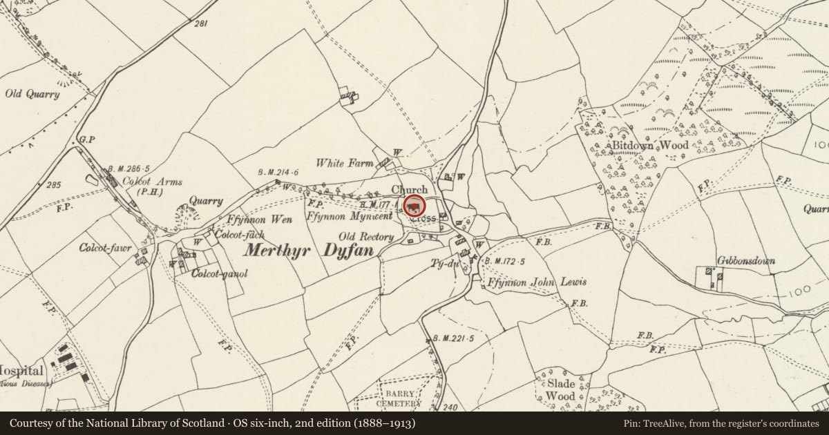
Slide toward Today to fade the historical sheet and see the modern map underneath.
David Rumsey Map Collection, Stanford LibrariesDavid Rumsey Map Collection, Stanford LibrariesDavid Rumsey Map Collection, Stanford LibrariesDavid Rumsey Map Collection, Stanford LibrariesDavid Rumsey Map Collection, Stanford Libraries
5 historical maps cover this location, the earliest the 1636 map "Cornubia : Devonia, Somersetus, Dorcestria, Wiltonia, Glocestria ..." (David Rumsey Map Collection, Stanford Libraries).
Historical maps covering this location
- 1636 · Cornubia : Devonia, Somersetus, Dorcestria, Wiltonia, Glocestria ... (David Rumsey Map Collection, Stanford Libraries)
- 1637 · The fourth table of England. Cornub. Devonia, Somerset etc. (David Rumsey Map Collection, Stanford Libraries)
- 1865 · England and Wales. England No. 6. (David Rumsey Map Collection, Stanford Libraries)
- 1898 · 263 Cardiff (Hills) (David Rumsey Map Collection, Stanford Libraries)
- 1913 · Sheet 110. Cardiff & Mouth of the Severn. (David Rumsey Map Collection, Stanford Libraries)
Cadw's description
History
C13 nave and chancel, C16 W tower, restoration of 1857 added porch, and altered windows. Restoration of tower 1909, and other parts of church in 1970s.
Exterior
Grey rubble with quoins in red stone; bathstone dressings, slate roofs. Square unbuttressed W tower has shallow staircase projection to N, castellated parapet on corbels, 4 stages. Steeply-pitched gabled S porch with Gothic arch, stone benches, window to E side. To L of porch, window with cusped head and square hoodmould, to R of porch, window with 2 cusped lights (square hoodmould), further window to R. N elevation of nave has 2-light window to W, single light window to E. Chancel has two lancets to S, high 2-light E window.
In churchyard to S of church is base of medieval Churchyard cross consisting of square socket on base of 2 square steps.
Interior
Chamfered chancel arch; C15/C16 arch-braced roof. Gothic wooden reredos of 1933, original medieval altar slab replaced 1974.
Reason for designation
Church graded II* as substantially complete late medieval building.
Nearby in the register
- Former Caretaker's Cottage at former Polytechnic of WalesDomesticunder 1 mi
- College Fields Nursing HomeEducationunder 1 mi
- Former Chapel at former Polytechnic of WalesReligious, Ritual and Funeraryunder 1 mi
- Vale Resource CentreCommercialunder 1 mi
Other entries of the same register within about three miles of this one, by straight line.