Cof Cymru: National Historic Assets of Wales · Wales
Osprey Hall
Wiston, Pembrokeshire, Wales
A Grade II listed building in Penty Park, Wiston, Pembrokeshire, designated on 7 December 1989.
The record
- Designation
- Listed building, Grade II
- Broad class
- Domestic
- Date of designation
- 7 December 1989
- Locality
- Penty Park
- Community
- Wiston
- Unitary authority
- Pembrokeshire
- Country
- Wales
- Coordinates
- 51.86212, -4.89136
- Cadw reference
- 13060
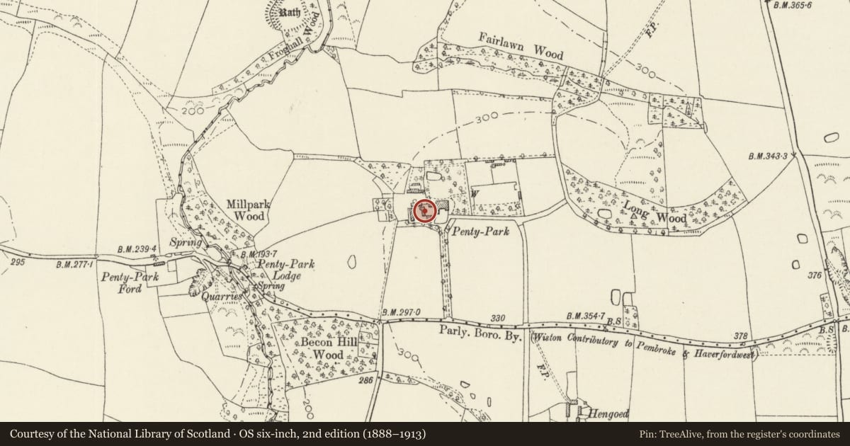
Slide toward Today to fade the historical sheet and see the modern map underneath.
David Rumsey Map Collection, Stanford LibrariesDavid Rumsey Map Collection, Stanford LibrariesDavid Rumsey Map Collection, Stanford LibrariesDavid Rumsey Map Collection, Stanford LibrariesDavid Rumsey Map Collection, Stanford Libraries
5 historical maps cover this location, the earliest the 1608 map "(13) Cambriae Typus." (David Rumsey Map Collection, Stanford Libraries).
Historical maps covering this location
- 1608 · (13) Cambriae Typus. (David Rumsey Map Collection, Stanford Libraries)
- 1636 · Cornubia : Devonia, Somersetus, Dorcestria, Wiltonia, Glocestria ... (David Rumsey Map Collection, Stanford Libraries)
- 1830 · V.3:11-15:XV. Britisches Reich. A. Kon: England. b. Frstenthum Wales: Shire: 37-40 (David Rumsey Map Collection, Stanford Libraries)
- 1891 · Sheet 10. Ordnance Survey of England and Wales. . (David Rumsey Map Collection, Stanford Libraries)
- 1901 · Sheet 13. (David Rumsey Map Collection, Stanford Libraries)
Cadw's description
Location
Situated in service court SW of mansion, running N - S, opposite coach-house/stable range and NW of stables.
History
Outbuilding range, probably mid to later C19. Converted to house in 1990s.
Exterior
Outbuilding, rubble stone with slate roof, overhanging at gables, and brick ridge stack towards S end. Single-storey long range with raised plinth. E side has large 12-pane sash to left and right of chimney, two doors and a casement-pair. Brick heads of red and white bricks, slate sills. S end has two similar 12-pane sashes. W side has lean-to to left (with S end door) and two casement pair windows with brick heads, then, to right of chimney, a large 12-pane sash. Brick heads. N end has two casement-pairs below and one, inserted, in gable. Casement pair in N end of lean-to.
Reason for designation
Included as part of a group in an extensive later C19 estate yard.
Nearby in the register
- Stables at Penty ParkDomesticunder 1 mi
- Tithe BarnDomesticunder 1 mi
- Pond HouseDomesticunder 1 mi
- Penty ParkDomesticunder 1 mi
Other entries of the same register within about three miles of this one, by straight line.