Cof Cymru: National Historic Assets of Wales · Wales
Stables at Penty Park
Wiston, Pembrokeshire, Wales
A Grade II listed building in Penty Park, Wiston, Pembrokeshire, designated on 7 December 1989.
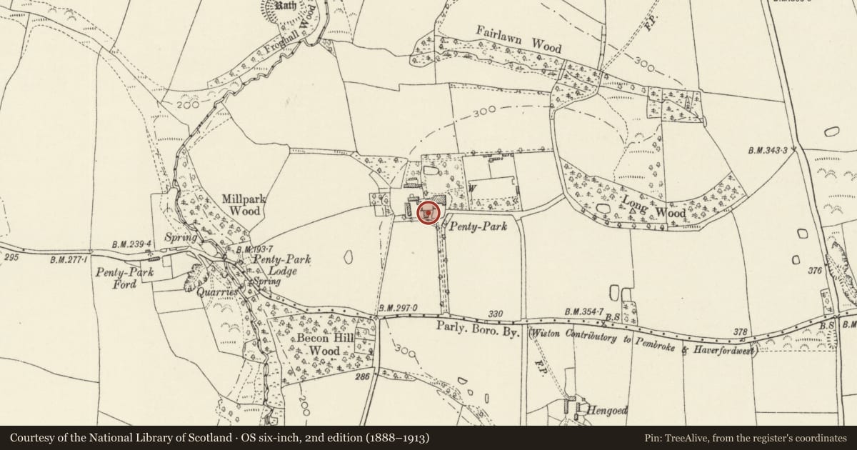
The record
- Designation
- Listed building, Grade II
- Broad class
- Domestic
- Date of designation
- 7 December 1989
- Locality
- Penty Park
- Community
- Wiston
- Unitary authority
- Pembrokeshire
- Country
- Wales
- Coordinates
- 51.86198, -4.89117
- Cadw reference
- 13058
Slide toward Today to fade the historical sheet and see the modern map underneath.
David Rumsey Map Collection, Stanford LibrariesDavid Rumsey Map Collection, Stanford LibrariesDavid Rumsey Map Collection, Stanford LibrariesDavid Rumsey Map Collection, Stanford LibrariesDavid Rumsey Map Collection, Stanford Libraries
5 historical maps cover this location, the earliest the 1608 map "(13) Cambriae Typus." (David Rumsey Map Collection, Stanford Libraries).
Historical maps covering this location
- 1608 · (13) Cambriae Typus. (David Rumsey Map Collection, Stanford Libraries)
- 1636 · Cornubia : Devonia, Somersetus, Dorcestria, Wiltonia, Glocestria ... (David Rumsey Map Collection, Stanford Libraries)
- 1830 · V.3:11-15:XV. Britisches Reich. A. Kon: England. b. Frstenthum Wales: Shire: 37-40 (David Rumsey Map Collection, Stanford Libraries)
- 1891 · Sheet 10. Ordnance Survey of England and Wales. . (David Rumsey Map Collection, Stanford Libraries)
- 1901 · Sheet 13. (David Rumsey Map Collection, Stanford Libraries)
Cadw's description
Location
Situated in former stable yard SW of Penty Park, facing E towards front garden of the house.
History
Lofted stables to Penty Park, probably of c. 1830-40, for Col. James Phillips Lloyd, died 1837.
Exterior
Lofted stables, roughcast rubble stone with slate eaves roof. Formal E front of 3 bays with centre bay slightly projected. Blind lunette over centre door, blind rectangular panel over casement-pair window each side. Red brick heads exposed by eroding render. Raised plinth. Left end has door to right of added rubble-stone lean-to with cambered-headed window and door. Rear has lean-to with broad elliptical-arched S end entry with brick arch and rear W door to right of centre, window to left, brick heads. Rear lean-to is not full-length as against N end is flight of slate and brick steps up to loft door in rear of main range. Rear roof slope has 3 roof-lights and small brick chimney at right corner.
Interior
Plastered walls and ceiling, cobbled floor and wooden stall-dividers with chamfered newels. Five stalls originally, one divider removed.
Reason for designation
Included as a formally-designed early C19 stables, of group value with Penty Park.
Nearby in the register
- Osprey HallDomesticunder 1 mi
- Penty ParkDomesticunder 1 mi
- Pond HouseDomesticunder 1 mi
- Tithe BarnDomesticunder 1 mi
Other entries of the same register within about three miles of this one, by straight line.