Cof Cymru: National Historic Assets of Wales · Wales
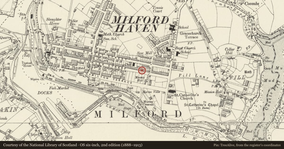
119 Charles Street
Milford Haven, Pembrokeshire, Wales
A Grade II listed building in Milford Haven, Pembrokeshire, designated on 22 February 1993.
The record
- Designation
- Listed building, Grade II
- Broad class
- Domestic
- Date of designation
- 22 February 1993
- Community
- Milford Haven
- Unitary authority
- Pembrokeshire
- Country
- Wales
- Coordinates
- 51.71261, -5.03138
- Cadw reference
- 12817
Slide toward Today to fade the historical sheet and see the modern map underneath.
David Rumsey Map Collection, Stanford LibrariesDavid Rumsey Map Collection, Stanford LibrariesDavid Rumsey Map Collection, Stanford LibrariesDavid Rumsey Map Collection, Stanford LibrariesDavid Rumsey Map Collection, Stanford Libraries
5 historical maps cover this location, the earliest the 1636 map "Cornubia : Devonia, Somersetus, Dorcestria, Wiltonia, Glocestria ..." (David Rumsey Map Collection, Stanford Libraries).
Historical maps covering this location
- 1636 · Cornubia : Devonia, Somersetus, Dorcestria, Wiltonia, Glocestria ... (David Rumsey Map Collection, Stanford Libraries)
- 1865 · England and Wales. England No. 6. (David Rumsey Map Collection, Stanford Libraries)
- 1898 · 227 Milford (Outline) (David Rumsey Map Collection, Stanford Libraries)
- 1898 · 227 Milford (Hills) (David Rumsey Map Collection, Stanford Libraries)
- 1901 · Sheet 13. (David Rumsey Map Collection, Stanford Libraries)
Cadw's description
Location
Situated in terraced row between Francis and Mansfield Streets.
Exterior
Circa l800 terrace house, part of a once uniform pair wth No 121, slate-hung and colourwashed with slate roof and red brick W end stack. Similar to No 117. Two-storey two-window front with l2-pane sashes above, 12-pane sash below and door to right. Plain C20 door.
Reason for designation
Included for group value with Nos 111-7 (odd) as one of the relatively unaltered early houses in Milford, built as part of the planned town between l797 and l8l0.
Nearby in the register
- 117 Charles StreetDomesticunder 1 mi
- 113 Charles StreetDomesticunder 1 mi
- Tabernacle Congregational ChapelReligious, Ritual and Funeraryunder 1 mi
- 111 Charles StreetDomesticunder 1 mi
Other entries of the same register within about three miles of this one, by straight line.