Cof Cymru: National Historic Assets of Wales · Wales
Pumphouse Tower in grounds of Warpool Court Hotel
St. David's and the Cathedral Close, Pembrokeshire, Wales
A Grade II listed building in St Non's, St. David's and the Cathedral Close, Pembrokeshire, designated on 28 July 1992.
The record
- Designation
- Listed building, Grade II
- Broad class
- Industrial
- Date of designation
- 28 July 1992
- Locality
- St Non's
- Community
- St. David's and the Cathedral Close
- Unitary authority
- Pembrokeshire
- Country
- Wales
- Coordinates
- 51.87600, -5.26888
- Cadw reference
- 12717
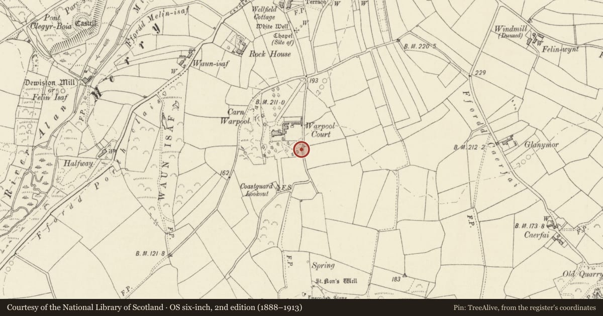
Slide toward Today to fade the historical sheet and see the modern map underneath.
David Rumsey Map Collection, Stanford LibrariesDavid Rumsey Map Collection, Stanford LibrariesDavid Rumsey Map Collection, Stanford LibrariesDavid Rumsey Map Collection, Stanford LibrariesDavid Rumsey Map Collection, Stanford Libraries
5 historical maps cover this location, the earliest the 1608 map "(13) Cambriae Typus." (David Rumsey Map Collection, Stanford Libraries).
Historical maps covering this location
- 1608 · (13) Cambriae Typus. (David Rumsey Map Collection, Stanford Libraries)
- 1636 · Cornubia : Devonia, Somersetus, Dorcestria, Wiltonia, Glocestria ... (David Rumsey Map Collection, Stanford Libraries)
- 1637 · Particular description of Wales. Cambria seu Wallia (David Rumsey Map Collection, Stanford Libraries)
- 1898 · 209 St David's (Hills) (David Rumsey Map Collection, Stanford Libraries)
- 1901 · Sheet 13. (David Rumsey Map Collection, Stanford Libraries)
Cadw's description
Location
Situated some 25m to S of walled garden, adjacent to boundary wall along lane to Saint Non's.
Exterior
Later C19 pumphouse treated as folly tower in rubble stone with ornament in red and black brick. Corbelled stone parapet with red brick corbel table; broad and low west arch of three orders, black brick outer arch, red brick inner and alternated colours between. Low jambs, red brick outer and inner, black in-between. Eroded steps or ramp up to N side doorway with black brick jambs and red brick plain arch. Interior roofless with derelict cast-iron pump.
Reason for designation
Group value with Warpool Court.
Nearby in the register
- Walled Garden & attached Tower on grounds of Warpool Court HotelDomesticunder 1 mi
- Garden Terrace, Hemicycle & Archway at Warpool Court HotelGardens, Parks and Urban Spacesunder 1 mi
- Warpool court HotelCommercialunder 1 mi
- Coach-House at Y FagwrDomesticunder 1 mi
Other entries of the same register within about three miles of this one, by straight line.