Cof Cymru: National Historic Assets of Wales · Wales
Lifeboat House
St. David's and the Cathedral Close, Pembrokeshire, Wales
A Grade II listed building in Porthstinian/St Justinian's, St. David's and the Cathedral Close, Pembrokeshire, designated on 28 July 1992.
The record
- Designation
- Listed building, Grade II
- Broad class
- Maritime
- Date of designation
- 28 July 1992
- Locality
- Porthstinian/St Justinian's
- Community
- St. David's and the Cathedral Close
- Unitary authority
- Pembrokeshire
- Country
- Wales
- Coordinates
- 51.87859, -5.30899
- Cadw reference
- 12695
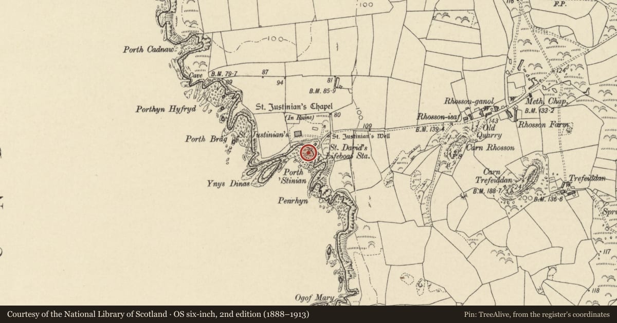
Slide toward Today to fade the historical sheet and see the modern map underneath.
David Rumsey Map Collection, Stanford LibrariesDavid Rumsey Map Collection, Stanford LibrariesDavid Rumsey Map Collection, Stanford LibrariesDavid Rumsey Map Collection, Stanford LibrariesDavid Rumsey Map Collection, Stanford Libraries
5 historical maps cover this location, the earliest the 1608 map "(13) Cambriae Typus." (David Rumsey Map Collection, Stanford Libraries).
Historical maps covering this location
- 1608 · (13) Cambriae Typus. (David Rumsey Map Collection, Stanford Libraries)
- 1636 · Cornubia : Devonia, Somersetus, Dorcestria, Wiltonia, Glocestria ... (David Rumsey Map Collection, Stanford Libraries)
- 1637 · Particular description of Wales. Cambria seu Wallia (David Rumsey Map Collection, Stanford Libraries)
- 1898 · 209 St David's (Hills) (David Rumsey Map Collection, Stanford Libraries)
- 1901 · Sheet 13. (David Rumsey Map Collection, Stanford Libraries)
Cadw's description
Location
Situated in Porthstinian cove some 3km off Saint David's.
History
1911 lifeboat house, designed by W T Douglas of London, engineer and architect to the RNLI. Set on high reinforced concrete latticed piers supporting flat deck to E with steep steps up and sloping slipway to W; the lifeboat house encloses top end of slipway.
Exterior
Functional timber-framed walls clad in painted corrugated iron and curved roof of similar cladding carried on thin bolted steel trusses. Three windows each side, casement pairs with top-lights, stepping down slope. Rear central door with cambered-headed casement pair above. Front curved gable, with modern plastic-coated window, slightly overhanging full-width folding timber doors. Galleried room over front is later C20 addition. Lifeboat house was built to accommodate new motor lifeboat after the disastrous 1910 loss of the previous boat with three of the crew.
Nearby in the register
- Old Lifeboat HouseMaritimeunder 1 mi
- Ruins of St Justinian's ChapelReligious, Ritual and Funeraryunder 1 mi
- St Justinian's WellWater Supply and Drainageunder 1 mi
- St Justinian's ChapelChapelunder 1 mi
Other entries of the same register within about three miles of this one, by straight line.