Cof Cymru: National Historic Assets of Wales · Wales
Ruins of St Justinian's Chapel
St. David's and the Cathedral Close, Pembrokeshire, Wales
A Grade I listed building in Porthstinian/St Justinian's, St. David's and the Cathedral Close, Pembrokeshire, designated on 1 March 1963.
The record
- Designation
- Listed building, Grade I
- Broad class
- Religious, Ritual and Funerary
- Date of designation
- 1 March 1963
- Locality
- Porthstinian/St Justinian's
- Community
- St. David's and the Cathedral Close
- Unitary authority
- Pembrokeshire
- Country
- Wales
- Coordinates
- 51.87908, -5.30936
- Cadw reference
- 12692
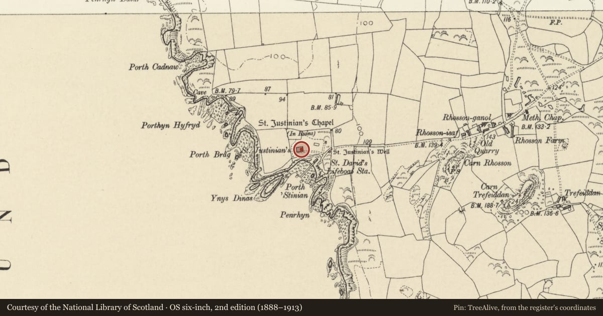
Slide toward Today to fade the historical sheet and see the modern map underneath.
David Rumsey Map Collection, Stanford LibrariesDavid Rumsey Map Collection, Stanford LibrariesDavid Rumsey Map Collection, Stanford LibrariesDavid Rumsey Map Collection, Stanford LibrariesDavid Rumsey Map Collection, Stanford Libraries
5 historical maps cover this location, the earliest the 1608 map "(13) Cambriae Typus." (David Rumsey Map Collection, Stanford Libraries).
Historical maps covering this location
- 1608 · (13) Cambriae Typus. (David Rumsey Map Collection, Stanford Libraries)
- 1636 · Cornubia : Devonia, Somersetus, Dorcestria, Wiltonia, Glocestria ... (David Rumsey Map Collection, Stanford Libraries)
- 1637 · Particular description of Wales. Cambria seu Wallia (David Rumsey Map Collection, Stanford Libraries)
- 1898 · 209 St David's (Hills) (David Rumsey Map Collection, Stanford Libraries)
- 1901 · Sheet 13. (David Rumsey Map Collection, Stanford Libraries)
Cadw's description
Location
Situated in the grounds of Saint Justinian's, some 60m E of house.
History
Early C16, ruins of chapel on supposed burial site of Saint Justinian, reputedly rebuilt by Bishop Vaughan (1509-22) but very probably including earlier work.
Chapel is reputedly the burial place of Saint Justinian, Breton contemporary of Saint David, martyred by jealous monks on Ramsey Island.
Exterior
Rubble stone, roofless, walls standing some 4m high. Rectanhular plan some 12m by 5m with variuos openings robbed of their ashlar fromas. Corbel table all around, interrupted by head of E window. Early descriptions suggest battlements, gables and a small battlemented tower, all gone now. Three windows each side of varied sizes and two doors on N. W end door, E end window apparently segment-headed.
Interior
Segment-headed arcading on each side, not matching, evidence of a chancel division from rood-beams and single step up. Traces of piscina and aumbry recess in chancel and broad " end segmental-pointed blank arch. SW angle had stair.
Nearby in the register
- St Justinian's ChapelChapelunder 1 mi
- Old Lifeboat HouseMaritimeunder 1 mi
- Lifeboat HouseMaritimeunder 1 mi
- Watch Tower to NW. of St. Justinian'sMaritimeunder 1 mi
Other entries of the same register within about three miles of this one, by straight line.