Cof Cymru: National Historic Assets of Wales · Wales
Watch Tower to NW. of St. Justinian's
St. David's and the Cathedral Close, Pembrokeshire, Wales
A Grade II listed building in Porthstinian/St Justinian's, St. David's and the Cathedral Close, Pembrokeshire, designated on 28 July 1992.
The record
- Designation
- Listed building, Grade II
- Broad class
- Maritime
- Date of designation
- 28 July 1992
- Locality
- Porthstinian/St Justinian's
- Community
- St. David's and the Cathedral Close
- Unitary authority
- Pembrokeshire
- Country
- Wales
- Coordinates
- 51.87960, -5.30991
- Cadw reference
- 12694
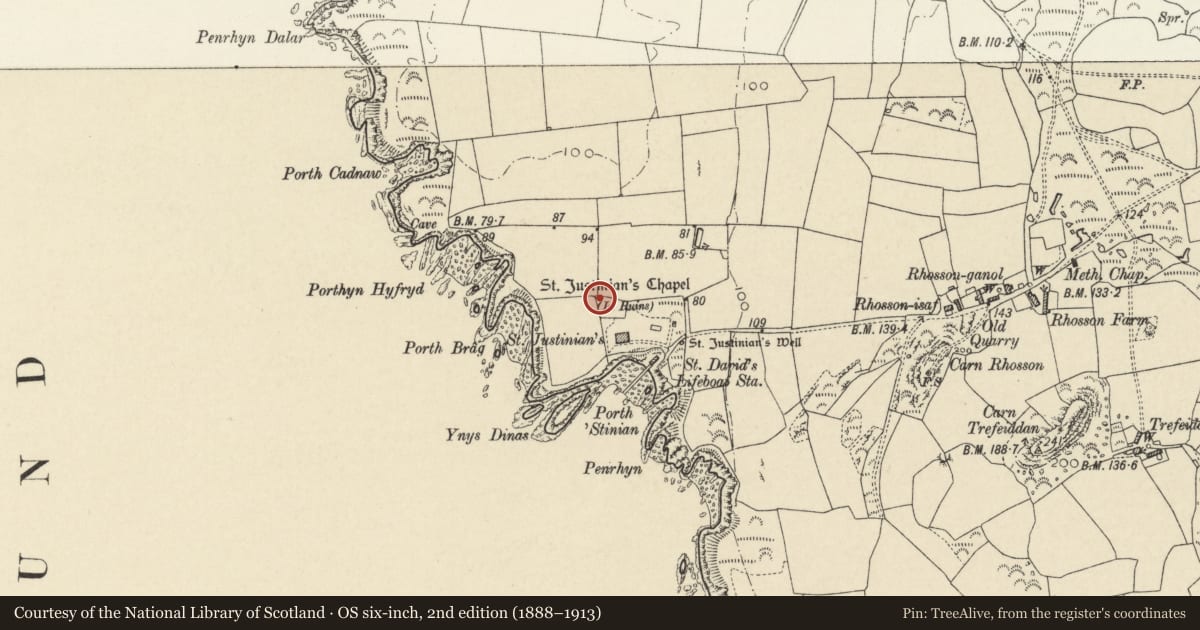
Slide toward Today to fade the historical sheet and see the modern map underneath.
David Rumsey Map Collection, Stanford LibrariesDavid Rumsey Map Collection, Stanford LibrariesDavid Rumsey Map Collection, Stanford LibrariesDavid Rumsey Map Collection, Stanford LibrariesDavid Rumsey Map Collection, Stanford Libraries
5 historical maps cover this location, the earliest the 1608 map "(13) Cambriae Typus." (David Rumsey Map Collection, Stanford Libraries).
Historical maps covering this location
- 1608 · (13) Cambriae Typus. (David Rumsey Map Collection, Stanford Libraries)
- 1636 · Cornubia : Devonia, Somersetus, Dorcestria, Wiltonia, Glocestria ... (David Rumsey Map Collection, Stanford Libraries)
- 1637 · Particular description of Wales. Cambria seu Wallia (David Rumsey Map Collection, Stanford Libraries)
- 1898 · 209 St David's (Hills) (David Rumsey Map Collection, Stanford Libraries)
- 1901 · Sheet 13. (David Rumsey Map Collection, Stanford Libraries)
Cadw's description
Location
Situated in NW corner of grounds of St Justinian's, some 100m from house and prominently visible from land and sea.
Exterior
Earlier C20 circular look-out tower in colourwashed rubble stone with slate octagonal roof and modern red dragon iron weathercock. Two storeys with four upper windows under eaves and ground floor similar windows to S and W, all modern 4-pane sashes. Door to east. Painted cambered brick heads to lower openings. Painted slate sills.
Interior
Gutted and under reconstruction 1989.
Reason for designation
Said to have been built as look-out by an owner of Saint Justinian's bungalow, which dates from 1909.
Included as prominent coastal feature.
Nearby in the register
- Ruins of St Justinian's ChapelReligious, Ritual and Funeraryunder 1 mi
- St Justinian's ChapelChapelunder 1 mi
- Old Lifeboat HouseMaritimeunder 1 mi
- Lifeboat HouseMaritimeunder 1 mi
Other entries of the same register within about three miles of this one, by straight line.