Cof Cymru: National Historic Assets of Wales · Wales
2 Goat Street
St. David's and the Cathedral Close, Pembrokeshire, Wales
A Grade II listed building in St. David's and the Cathedral Close, Pembrokeshire, designated on 26 August 1981.
The record
- Designation
- Listed building, Grade II
- Broad class
- Domestic
- Date of designation
- 26 August 1981
- Community
- St. David's and the Cathedral Close
- Unitary authority
- Pembrokeshire
- Country
- Wales
- Coordinates
- 51.88103, -5.26641
- Cadw reference
- 12593
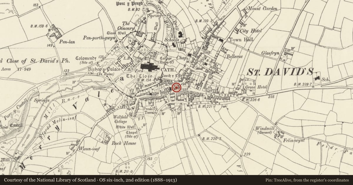
Slide toward Today to fade the historical sheet and see the modern map underneath.
David Rumsey Map Collection, Stanford LibrariesDavid Rumsey Map Collection, Stanford LibrariesDavid Rumsey Map Collection, Stanford LibrariesDavid Rumsey Map Collection, Stanford LibrariesDavid Rumsey Map Collection, Stanford Libraries
5 historical maps cover this location, the earliest the 1608 map "(13) Cambriae Typus." (David Rumsey Map Collection, Stanford Libraries).
Historical maps covering this location
- 1608 · (13) Cambriae Typus. (David Rumsey Map Collection, Stanford Libraries)
- 1636 · Cornubia : Devonia, Somersetus, Dorcestria, Wiltonia, Glocestria ... (David Rumsey Map Collection, Stanford Libraries)
- 1637 · Particular description of Wales. Cambria seu Wallia (David Rumsey Map Collection, Stanford Libraries)
- 1898 · 209 St David's (Hills) (David Rumsey Map Collection, Stanford Libraries)
- 1901 · Sheet 13. (David Rumsey Map Collection, Stanford Libraries)
Cadw's description
Location
Situated at eastern end of Goat Street, between Y Tabernacl and 22 Cross Square.
History
Old photographs show that the houses were apparently rebuilt near turn of the century; No 4 shown with smaller fenestration, though upper floor only may have been raised.
Exterior
Late C19 semi-detached pair of houses in rubble stone with slate roofs (No 2 had grouted roof 1981) and three stone stacks. Two storeys, two-window range to No 2 and three-window range to No 4. No 4 has been painted externally but otherwise the houses are similar, sash windows with marginal glazing bars, slate sills and cambered brick heads, doors originally with overlights. No 2 has had brick heads renewed, flat to upper windows and door, modern half-glazed door. No 4 has centre door with cambered head, half-glazed door with traceried overlight.
Dwarf walls enclosing narrow front areas with patterned iron railings and gates.
Reason for designation
Included for group value in views out of Cross Square.
Nearby in the register
- 4 Goat StreetDomesticunder 1 mi
- Cartref RestaurantCommercialunder 1 mi
- Barometer Case against front wall of No. 19 Cross SquareGardens, Parks and Urban Spacesunder 1 mi
- 1 Goat StreetDomesticunder 1 mi
Other entries of the same register within about three miles of this one, by straight line.