Cof Cymru: National Historic Assets of Wales · Wales
Cartref Restaurant
St. David's and the Cathedral Close, Pembrokeshire, Wales
A Grade II listed building in St. David's and the Cathedral Close, Pembrokeshire, designated on 26 August 1981.
The record
- Designation
- Listed building, Grade II
- Broad class
- Commercial
- Date of designation
- 26 August 1981
- Community
- St. David's and the Cathedral Close
- Unitary authority
- Pembrokeshire
- Country
- Wales
- Coordinates
- 51.88109, -5.26629
- Cadw reference
- 12582
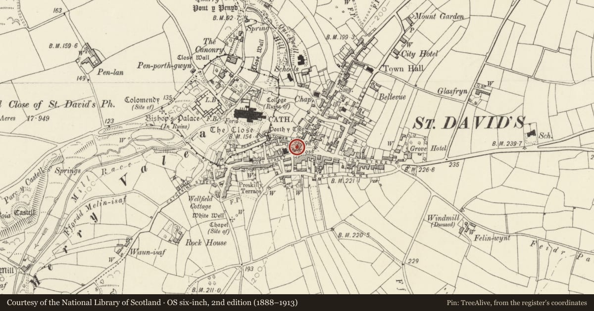
Slide toward Today to fade the historical sheet and see the modern map underneath.
David Rumsey Map Collection, Stanford LibrariesDavid Rumsey Map Collection, Stanford LibrariesDavid Rumsey Map Collection, Stanford LibrariesDavid Rumsey Map Collection, Stanford LibrariesDavid Rumsey Map Collection, Stanford Libraries
5 historical maps cover this location, the earliest the 1608 map "(13) Cambriae Typus." (David Rumsey Map Collection, Stanford Libraries).
Historical maps covering this location
- 1608 · (13) Cambriae Typus. (David Rumsey Map Collection, Stanford Libraries)
- 1636 · Cornubia : Devonia, Somersetus, Dorcestria, Wiltonia, Glocestria ... (David Rumsey Map Collection, Stanford Libraries)
- 1637 · Particular description of Wales. Cambria seu Wallia (David Rumsey Map Collection, Stanford Libraries)
- 1898 · 209 St David's (Hills) (David Rumsey Map Collection, Stanford Libraries)
- 1901 · Sheet 13. (David Rumsey Map Collection, Stanford Libraries)
Cadw's description
Location
Prominently sited on W side of square facing The Cross and down High Street.
History
C18 and later C19, two houses now one restaurant premises.
Exterior
No 22: to west is C18 (dated 1778 on corner stone to right) colourwashed rubble stone with grouted slate roof and large stone end stacks. One and a half storeys, three-window range with central door under timber lintel and 12-pane sash with rough slate lintel and slate sill each side. Attic has late C19 or early C20 eaves-breaking 12-pane sashes in timber gabled dormers. Rear outshut built up in C20. Old photographs shown no dormers but three narrow lights under eaves.
No 23: later C19, colourwashed render with raised cement dressings, an early C20 alteration as old photographs show rubble stone front with cambered brick window heads. Grouted slate roof with stone stack to left and rendered stack to right. Two storeys, three-window range of 12-pane sashes in raised surrounds and similar surround to centre door.
Reason for designation
Group value.
Nearby in the register
- 2 Goat StreetDomesticunder 1 mi
- 24 Cross SquareDomesticunder 1 mi
- 4 Goat StreetDomesticunder 1 mi
- Barometer Case against front wall of No. 19 Cross SquareGardens, Parks and Urban Spacesunder 1 mi
Other entries of the same register within about three miles of this one, by straight line.