Cof Cymru: National Historic Assets of Wales · Wales
Capel Bedyddwyr Elim/Elim Baptist Chapel
Llanrhian, Pembrokeshire, Wales
A Grade II listed building in Trefin/Trevine, Llanrhian, Pembrokeshire, designated on 4 February 1991.
The record
- Designation
- Listed building, Grade II
- Broad class
- Religious, Ritual and Funerary
- Date of designation
- 4 February 1991
- Locality
- Trefin/Trevine
- Community
- Llanrhian
- Unitary authority
- Pembrokeshire
- Country
- Wales
- Coordinates
- 51.94891, -5.14736
- Cadw reference
- 12438
Slide toward Today to fade the historical sheet and see the modern map underneath.
David Rumsey Map Collection, Stanford LibrariesDavid Rumsey Map Collection, Stanford LibrariesDavid Rumsey Map Collection, Stanford LibrariesDavid Rumsey Map Collection, Stanford LibrariesDavid Rumsey Map Collection, Stanford Libraries
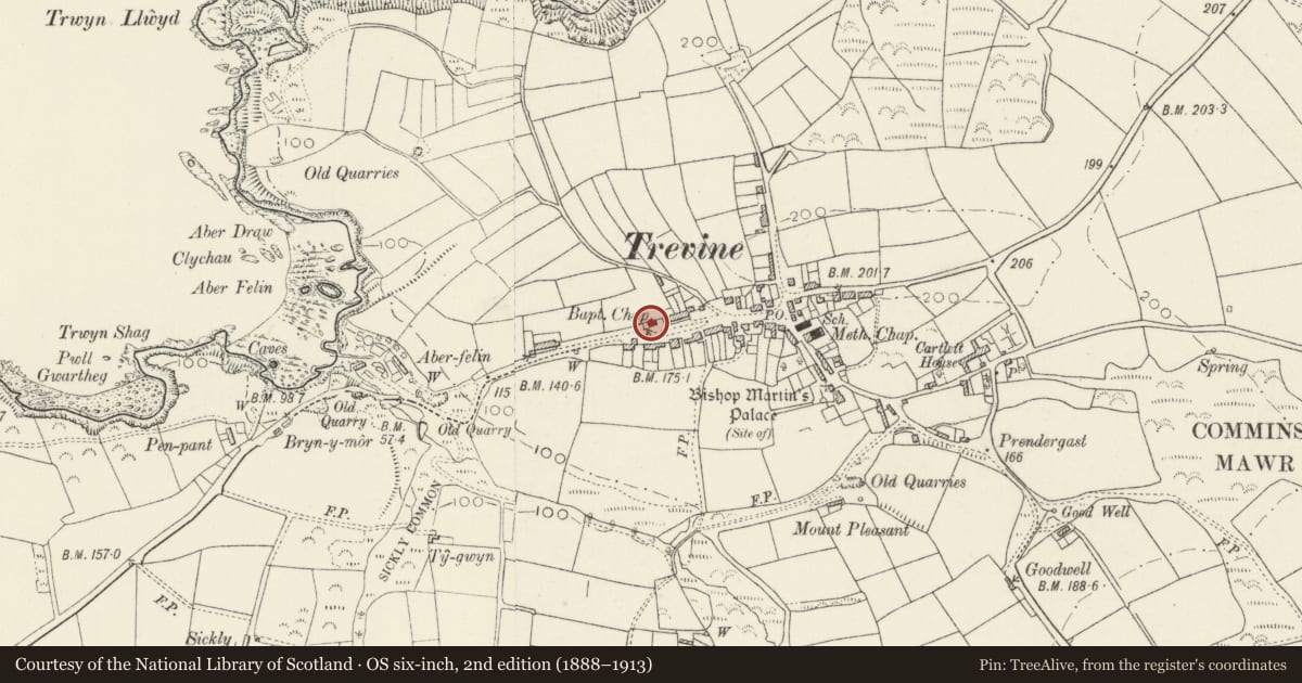
5 historical maps cover this location, the earliest the 1608 map "(13) Cambriae Typus." (David Rumsey Map Collection, Stanford Libraries).
Historical maps covering this location
- 1608 · (13) Cambriae Typus. (David Rumsey Map Collection, Stanford Libraries)
- 1636 · Cornubia : Devonia, Somersetus, Dorcestria, Wiltonia, Glocestria ... (David Rumsey Map Collection, Stanford Libraries)
- 1637 · Particular description of Wales. Cambria seu Wallia (David Rumsey Map Collection, Stanford Libraries)
- 1898 · 209 St David's (Hills) (David Rumsey Map Collection, Stanford Libraries)
- 1901 · Sheet 13. (David Rumsey Map Collection, Stanford Libraries)
Cadw's description
Location
Situated on north side of the main street, towards the west end.
Exterior
Mid C19 small chapel, unpainted cement render with grouted slate roof. Two long arched windows each side and formal W gable front of two long arched windows, small centre arched light and arched centre doorway all with moulded heads on acanthus brackets. Windows have centre timber mullion and Y-tracery heads. Plank double doors under Y-tracery fanlight with glazing bars.
Said to have been built in 1843.
Prominent location in village.
Interior
West gallery on two bulbous broad columns. Panelled gallery front. Panelled pulpit in front of E wall round-headed blank plaque in moulded plaster pedimented architrave.
Nearby in the register
- Capel Y Trefnyddion Calvinaidd/Calvinistic Methodist ChapelReligious, Ritual and Funeraryunder 1 mi
- Ffordd AbercastellDomesticunder 1 mi
- Aberfelin MillMillunder 1 mi
- Cartlett HouseDomesticunder 1 mi
Other entries of the same register within about three miles of this one, by straight line.