Cof Cymru: National Historic Assets of Wales · Wales
Bank Cottage
Llanrhian, Pembrokeshire, Wales
A Grade II listed building in Abereiddy, Llanrhian, Pembrokeshire, designated on 12 January 1976.
The record
- Designation
- Listed building, Grade II
- Broad class
- Domestic
- Date of designation
- 12 January 1976
- Locality
- Abereiddy
- Community
- Llanrhian
- Unitary authority
- Pembrokeshire
- Country
- Wales
- Coordinates
- 51.93599, -5.20404
- Cadw reference
- 12407
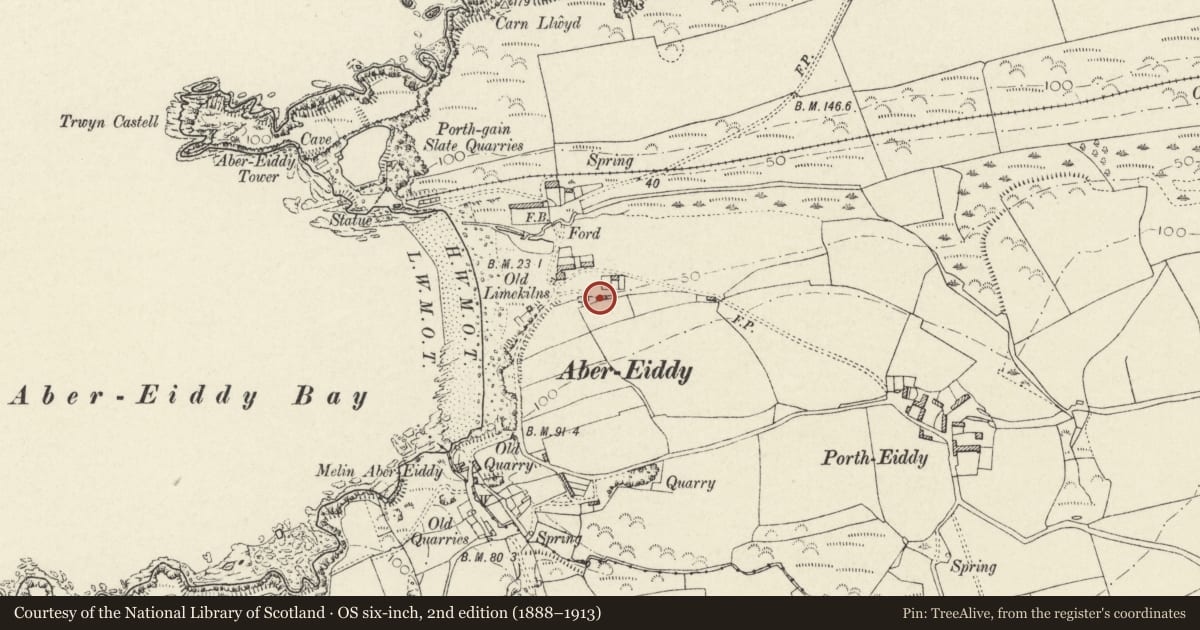
Slide toward Today to fade the historical sheet and see the modern map underneath.
David Rumsey Map Collection, Stanford LibrariesDavid Rumsey Map Collection, Stanford LibrariesDavid Rumsey Map Collection, Stanford LibrariesDavid Rumsey Map Collection, Stanford LibrariesDavid Rumsey Map Collection, Stanford Libraries
5 historical maps cover this location, the earliest the 1608 map "(13) Cambriae Typus." (David Rumsey Map Collection, Stanford Libraries).
Historical maps covering this location
- 1608 · (13) Cambriae Typus. (David Rumsey Map Collection, Stanford Libraries)
- 1636 · Cornubia : Devonia, Somersetus, Dorcestria, Wiltonia, Glocestria ... (David Rumsey Map Collection, Stanford Libraries)
- 1637 · Particular description of Wales. Cambria seu Wallia (David Rumsey Map Collection, Stanford Libraries)
- 1898 · 209 St David's (Hills) (David Rumsey Map Collection, Stanford Libraries)
- 1901 · Sheet 13. (David Rumsey Map Collection, Stanford Libraries)
Cadw's description
Location
Situated in the hamlet of Abereiddy, the eastern house of the two in the upper (southern) row.
Exterior
Early to mid C19 cottage in rubble stone with grouted slate roof and rubble end stacks. One and a half-storeys, double-fronted with brick cambered heads to centre door and 4-pane sash each side, 4-panel door. Two small pointed-head 4-pane sashes above, breaking eaves. Door is set in large gabled porch, late C20 rubble stone cladding, earlier painted brick. Rendered west wall. Front garden enclosed by rubble wall.
Reason for designation
Group value with Bank House.
Nearby in the register
- Bank HouseDomesticunder 1 mi
- Abereiddy Beach CottageDomesticunder 1 mi
- Swn-y-mor (previously listed as unoccupied cottage between beach cottage and the villa) AbereidyDomesticunder 1 mi
- The CwmDomesticunder 1 mi
Other entries of the same register within about three miles of this one, by straight line.