Cof Cymru: National Historic Assets of Wales · Wales
Abereiddy Beach Cottage
Llanrhian, Pembrokeshire, Wales
A Grade II listed building in Llanrhian, Pembrokeshire, designated on 12 January 1976.
The record
- Designation
- Listed building, Grade II
- Broad class
- Domestic
- Date of designation
- 12 January 1976
- Community
- Llanrhian
- Unitary authority
- Pembrokeshire
- Country
- Wales
- Coordinates
- 51.93630, -5.20492
- Cadw reference
- 12404
Slide toward Today to fade the historical sheet and see the modern map underneath.
David Rumsey Map Collection, Stanford LibrariesDavid Rumsey Map Collection, Stanford LibrariesDavid Rumsey Map Collection, Stanford LibrariesDavid Rumsey Map Collection, Stanford LibrariesDavid Rumsey Map Collection, Stanford Libraries
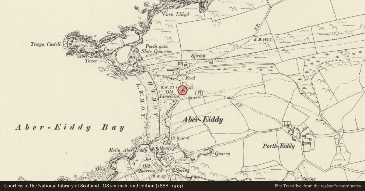
5 historical maps cover this location, the earliest the 1608 map "(13) Cambriae Typus." (David Rumsey Map Collection, Stanford Libraries).
Historical maps covering this location
- 1608 · (13) Cambriae Typus. (David Rumsey Map Collection, Stanford Libraries)
- 1636 · Cornubia : Devonia, Somersetus, Dorcestria, Wiltonia, Glocestria ... (David Rumsey Map Collection, Stanford Libraries)
- 1637 · Particular description of Wales. Cambria seu Wallia (David Rumsey Map Collection, Stanford Libraries)
- 1898 · 209 St David's (Hills) (David Rumsey Map Collection, Stanford Libraries)
- 1901 · Sheet 13. (David Rumsey Map Collection, Stanford Libraries)
Cadw's description
Location
Situated in the hamlet of Abereiddy, the first house in the lower (northern) row.
Exterior
Early C19 cottage, formerly two, in rubble stone with grouted slate roofs. The main part two-storey with rubble stone north end stack, one-room plan; the right section single storey and loft, two-room with rubble stone end stacks. Picturesquely irregular roof line. Main part has 9-pane sash above, 12-pane sash below and 4-pane door to right under C20 gabled timber hood. Ground floor lintels renewed in concrete. Whitewashed N end wall has C20 ground floor window in original opening, 9-pane window above. Lower range to south has 16-pane sash to left and C20 window in former door to right. South end wall has blocked door and small loft window. Out rear. Front garden enclosed by whitewashed rubble wall. Slate path to front door.
Reason for designation
Group value with Swn-y-Mor adjoining.
Nearby in the register
- Swn-y-mor (previously listed as unoccupied cottage between beach cottage and the villa) AbereidyDomesticunder 1 mi
- Bank HouseDomesticunder 1 mi
- Bank CottageDomesticunder 1 mi
- The CwmDomesticunder 1 mi
Other entries of the same register within about three miles of this one, by straight line.