Cof Cymru: National Historic Assets of Wales · Wales
Old Post Office Building
Neath, Neath Port Talbot, Wales
A Grade II listed building in Neath, Neath Port Talbot, designated on 5 January 1989.
The record
- Designation
- Listed building, Grade II
- Broad class
- Communications
- Date of designation
- 5 January 1989
- Community
- Neath
- Unitary authority
- Neath Port Talbot
- Country
- Wales
- Coordinates
- 51.66167, -3.80690
- Cadw reference
- 11827
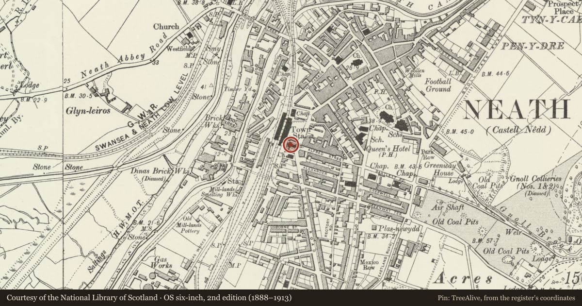
Slide toward Today to fade the historical sheet and see the modern map underneath.
David Rumsey Map Collection, Stanford LibrariesDavid Rumsey Map Collection, Stanford LibrariesDavid Rumsey Map Collection, Stanford LibrariesDavid Rumsey Map Collection, Stanford LibrariesDavid Rumsey Map Collection, Stanford Libraries
5 historical maps cover this location, the earliest the 1636 map "Cornubia : Devonia, Somersetus, Dorcestria, Wiltonia, Glocestria ..." (David Rumsey Map Collection, Stanford Libraries).
Historical maps covering this location
- 1636 · Cornubia : Devonia, Somersetus, Dorcestria, Wiltonia, Glocestria ... (David Rumsey Map Collection, Stanford Libraries)
- 1637 · The fourth table of England. Cornub. Devonia, Somerset etc. (David Rumsey Map Collection, Stanford Libraries)
- 1865 · England and Wales. England No. 6. (David Rumsey Map Collection, Stanford Libraries)
- 1891 · Sheet 10. Ordnance Survey of England and Wales. . (David Rumsey Map Collection, Stanford Libraries)
- 1897 · 247 Swansea (Hills) (David Rumsey Map Collection, Stanford Libraries)
Cadw's description
Location
On the street line opposite the junction with Alfred Street and adjoining the present Post Office.
History
1927 showing influence of Queen Anne Revival.
Exterior
Two storey and attic 4 window, irregular stonework laid to courses. Steeply pitched modern slate roof, shouldered raking gable parapets. Moulded stone cornice dropped below eaves level, incorporating lander with contemporary rainwater goods to ends. Dated 1927 to waterheads.
Four hipped dormers to attic, slightly swept slate roofs, slated cheeks, lead valleys. Nine pane horned sashes in flush frames.
Four, 15 pane horned sash windows to first floor, flush frames; regular stone voussoirs, stone sills. Ventilation blocks set below sills.
Three bay ashlar arcade flanked by doorways to ground floor. Moulded round arches with keystones, resting on corniced impost band. Ashlar masonry plinth, small paned around arched windows recessed under arches. Doorway to extreme left and right.
Stone voussoirs, with stressed keystones. Panelled double doors.
Reason for designation
Contemporary wall post box to right of left hand doorway.
Nearby in the register
- Lloyd's BankCommercialunder 1 mi
- Midland BankCommercialunder 1 mi
- Soar Maes-yr-haf Congregational Chapel and forecourt railingsReligious, Ritual and Funeraryunder 1 mi
- National Westminster BankCommercialunder 1 mi
Other entries of the same register within about three miles of this one, by straight line.