Cof Cymru: National Historic Assets of Wales · Wales
Midland Bank
Neath, Neath Port Talbot, Wales
A Grade II listed building in Neath, Neath Port Talbot, designated on 5 January 1989.
The record
- Designation
- Listed building, Grade II
- Broad class
- Commercial
- Date of designation
- 5 January 1989
- Town
- Neath
- Community
- Neath
- Unitary authority
- Neath Port Talbot
- Country
- Wales
- Coordinates
- 51.66209, -3.80607
- Cadw reference
- 11825
Slide toward Today to fade the historical sheet and see the modern map underneath.
David Rumsey Map Collection, Stanford LibrariesDavid Rumsey Map Collection, Stanford LibrariesDavid Rumsey Map Collection, Stanford LibrariesDavid Rumsey Map Collection, Stanford LibrariesDavid Rumsey Map Collection, Stanford Libraries
5 historical maps cover this location, the earliest the 1636 map "Cornubia : Devonia, Somersetus, Dorcestria, Wiltonia, Glocestria ..." (David Rumsey Map Collection, Stanford Libraries).
Historical maps covering this location
- 1636 · Cornubia : Devonia, Somersetus, Dorcestria, Wiltonia, Glocestria ... (David Rumsey Map Collection, Stanford Libraries)
- 1637 · The fourth table of England. Cornub. Devonia, Somerset etc. (David Rumsey Map Collection, Stanford Libraries)
- 1865 · England and Wales. England No. 6. (David Rumsey Map Collection, Stanford Libraries)
- 1891 · Sheet 10. Ordnance Survey of England and Wales. . (David Rumsey Map Collection, Stanford Libraries)
- 1897 · 247 Swansea (Hills) (David Rumsey Map Collection, Stanford Libraries)
Cadw's description
Location
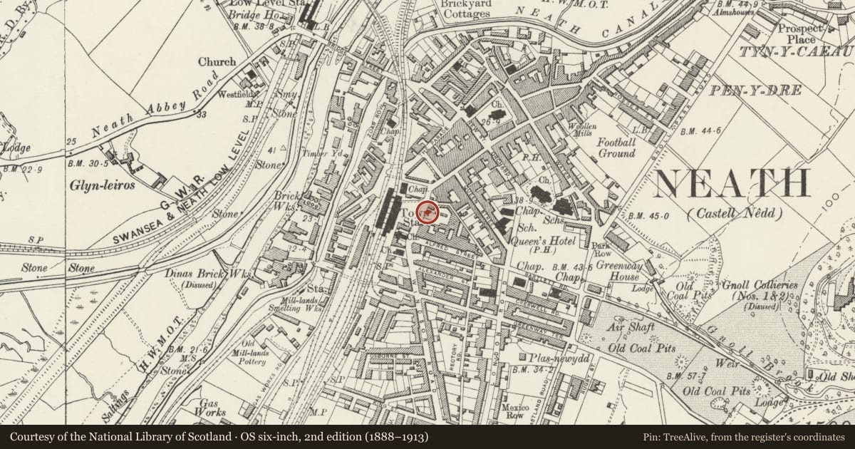
On the street line opposite the Railway Station.
History
Late C19/early C20 classical bank.
Exterior
Three storey 5 bay ashlar front. Triangular pediment over advanced 3 centre bays, modillion cornice. Egg and dart moulding to top of plain frieze; moulded architrave. Blocking courses. Four Ionic columns with torus moulded bases rise from first floor sill level. Similar detail to pilasters on outer bay.
Moulded shouldered architraves to second floor windows. Aprons drop to pediments over pulvinated friezes with side scrolls to first floor windows. Symmetrically disposed triangular and segmental pediments, moulded architraves. Sash windows, 6 small panes to upper sash only.
Plain entablature over channelled ground floor. Modern fascia sign. Advanced round arched doorways to outer bays, console keystones. Plain fanlights, panelled double doors.
Round arched windows to centre bays, stressed keystones, modern glazing, moulded sills. Two windows partly blocked for modern cash dispensers.
Interior
Modernised interior.
Reason for designation
Group value with Lloyds Bank adjoining.
Nearby in the register
- Lloyd's BankCommercialunder 1 mi
- National Westminster BankCommercialunder 1 mi
- Old Post Office BuildingCommunicationsunder 1 mi
- Soar Maes-yr-haf Congregational Chapel and forecourt railingsReligious, Ritual and Funeraryunder 1 mi
Other entries of the same register within about three miles of this one, by straight line.