Cof Cymru: National Historic Assets of Wales · Wales
The Pump House
Waterfront / Y Glannau, Swansea, Wales
A Grade II listed building in Pumphouse Quay, Waterfront / Y Glannau, Swansea, designated on 30 March 1987.
The record
- Designation
- Listed building, Grade II
- Broad class
- Industrial
- Date of designation
- 30 March 1987
- Locality
- Pumphouse Quay
- Community
- Waterfront / Y Glannau
- Unitary authority
- Swansea
- Country
- Wales
- Coordinates
- 51.61667, -3.93674
- Cadw reference
- 11614
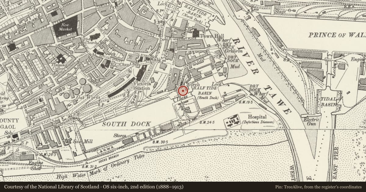
Slide toward Today to fade the historical sheet and see the modern map underneath.
David Rumsey Map Collection, Stanford LibrariesDavid Rumsey Map Collection, Stanford LibrariesDavid Rumsey Map Collection, Stanford LibrariesDavid Rumsey Map Collection, Stanford LibrariesDavid Rumsey Map Collection, Stanford Libraries
5 historical maps cover this location, the earliest the 1636 map "Cornubia : Devonia, Somersetus, Dorcestria, Wiltonia, Glocestria ..." (David Rumsey Map Collection, Stanford Libraries).
Historical maps covering this location
- 1636 · Cornubia : Devonia, Somersetus, Dorcestria, Wiltonia, Glocestria ... (David Rumsey Map Collection, Stanford Libraries)
- 1637 · The fourth table of England. Cornub. Devonia, Somerset etc. (David Rumsey Map Collection, Stanford Libraries)
- 1865 · England and Wales. England No. 6. (David Rumsey Map Collection, Stanford Libraries)
- 1891 · Sheet 10. Ordnance Survey of England and Wales. . (David Rumsey Map Collection, Stanford Libraries)
- 1897 · 247 Swansea (Hills) (David Rumsey Map Collection, Stanford Libraries)
Cadw's description
Location
Very prominently sited on quayside adjoining locks between inner and outer basins of S Dock. Formerly known as "Power Station".
History
Dated "SHT 1900", restored and altered 1985.
Exterior
2 storey industrial building, red brick with dark brick dressings, tall S tower (former accumulator?). Hipped slate roofs, projecting parapets and eaves with diagonal headers. Giant arch treatment to window bays, modern brickwork without dark dressings to W end; roll-moulded angles in dark brick to tower and adjoining bays. Oculi in blind panels to tower top, stonework band course and eaves, datestone with partly modern inscription at base, inset modern relief sculpture. Modern glazed lean-to extensions in angle to right, main entrance up modern steps.
3-bay rear elevation towards Gloucester Place with mostly original detailing, wall hand steps down to E with blind panels over 3-bay arcaded ground floor treatment. Further 3-bay arcaded and gabled elevation faces E.
Half length of bow-trussed girder swing-bridge (formerly operated by power from the Pump House) survives on quayside to SW.
Reason for designation
Group value.
Nearby in the register
- St. Nicholas Seamen's Church (Swansea Arts Workshop)Commercialunder 1 mi
- 6 Gloucester PlaceDomesticunder 1 mi
- 5 Gloucester PlaceDomesticunder 1 mi
- 4 Gloucester PlaceDomesticunder 1 mi
Other entries of the same register within about three miles of this one, by straight line.