Cof Cymru: National Historic Assets of Wales · Wales
St. Nicholas Seamen's Church (Swansea Arts Workshop)
Waterfront / Y Glannau, Swansea, Wales
A Grade II listed building in Waterfront / Y Glannau, Swansea, designated on 30 March 1987.
The record
- Designation
- Listed building, Grade II
- Broad class
- Commercial
- Date of designation
- 30 March 1987
- Community
- Waterfront / Y Glannau
- Unitary authority
- Swansea
- Country
- Wales
- Coordinates
- 51.61698, -3.93682
- Cadw reference
- 11582
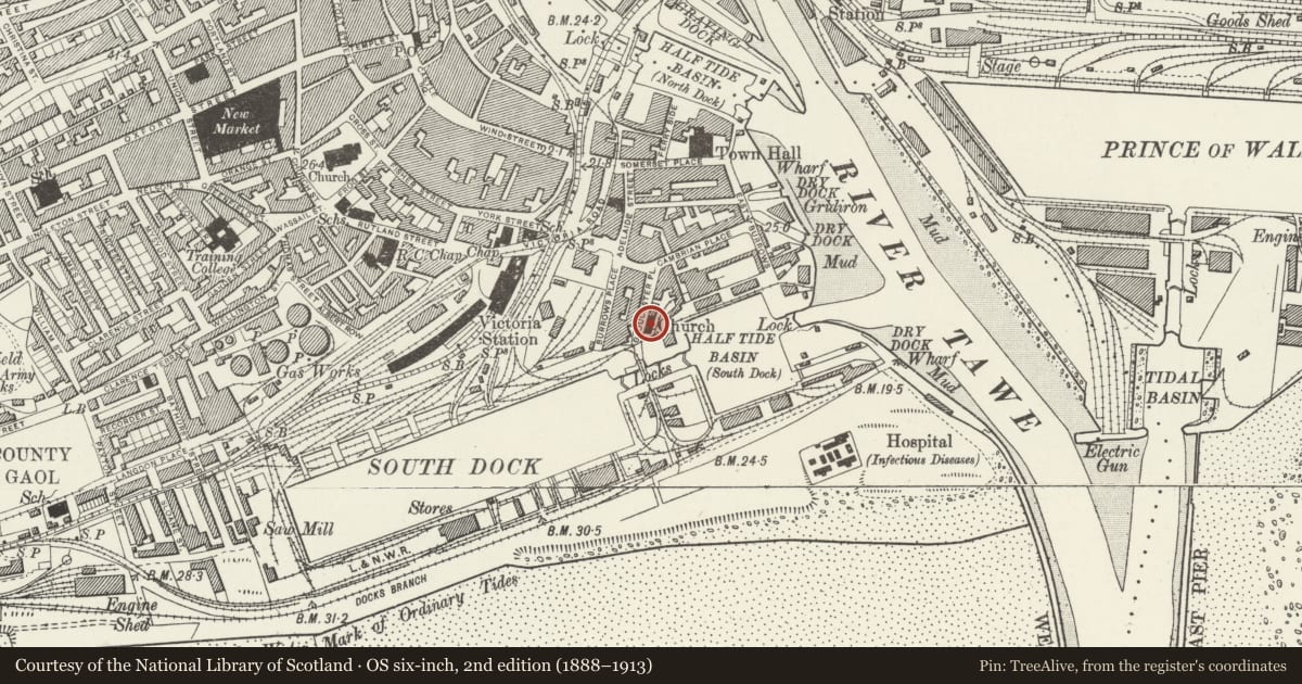
Slide toward Today to fade the historical sheet and see the modern map underneath.
David Rumsey Map Collection, Stanford LibrariesDavid Rumsey Map Collection, Stanford LibrariesDavid Rumsey Map Collection, Stanford LibrariesDavid Rumsey Map Collection, Stanford LibrariesDavid Rumsey Map Collection, Stanford Libraries
5 historical maps cover this location, the earliest the 1636 map "Cornubia : Devonia, Somersetus, Dorcestria, Wiltonia, Glocestria ..." (David Rumsey Map Collection, Stanford Libraries).
Historical maps covering this location
- 1636 · Cornubia : Devonia, Somersetus, Dorcestria, Wiltonia, Glocestria ... (David Rumsey Map Collection, Stanford Libraries)
- 1637 · The fourth table of England. Cornub. Devonia, Somerset etc. (David Rumsey Map Collection, Stanford Libraries)
- 1865 · England and Wales. England No. 6. (David Rumsey Map Collection, Stanford Libraries)
- 1891 · Sheet 10. Ordnance Survey of England and Wales. . (David Rumsey Map Collection, Stanford Libraries)
- 1897 · 247 Swansea (Hills) (David Rumsey Map Collection, Stanford Libraries)
Cadw's description
Location
At the dock end of the street close to the Pump House.
History
Opened 1868, later alterations. Designed by B Bucknall, architect of Swansea. Late Romanesque.
Exterior
Plan of apsidal chancel with porch and vestry in angles, taller single cell nave (now subdivided), W bellcote (partly taken down). Rubble facings, freestone dressings; tarred slate roofs, hipped over chancel, gable parapet with kneelers to nave (cut-down stack to rear). Corbel table to eaves of chancel and rear nave, linked nailhead, modern glazing and box-dormer to rear roof. Gloucester Place elevation with replaced windows and modern wide entry. Assorted additions to N end with brick arched doorway, gabled 3-light dormer with diamond tympanum under cusped bargeboards, cut-down buttresses to former bellcote.
Interior
Interior is largely modernised and retains only boarded, pointed nave ceiling and round chancel arch with chamfered imposts.
Reason for designation
Group value.
Nearby in the register
- 6 Gloucester PlaceDomesticunder 1 mi
- 5 Gloucester PlaceDomesticunder 1 mi
- 4 Gloucester PlaceDomesticunder 1 mi
- 3 Gloucester PlaceDomesticunder 1 mi
Other entries of the same register within about three miles of this one, by straight line.