Cof Cymru: National Historic Assets of Wales · Wales
4 Gloucester Place
Waterfront / Y Glannau, Swansea, Wales
A Grade II listed building in Waterfront / Y Glannau, Swansea, designated on 30 March 1987.
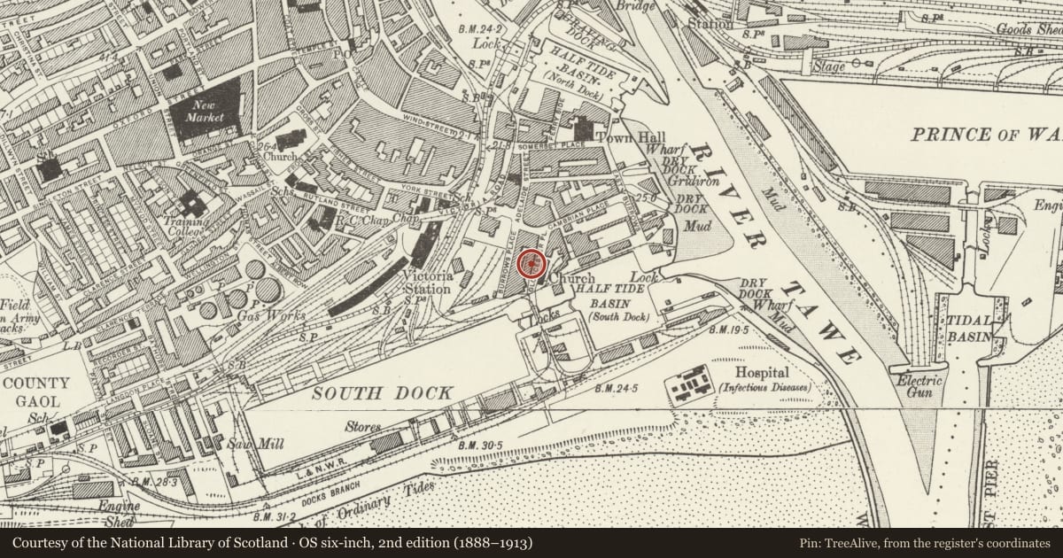
The record
- Designation
- Listed building, Grade II
- Broad class
- Domestic
- Date of designation
- 30 March 1987
- Community
- Waterfront / Y Glannau
- Unitary authority
- Swansea
- Country
- Wales
- Coordinates
- 51.61717, -3.93710
- Cadw reference
- 11579
Slide toward Today to fade the historical sheet and see the modern map underneath.
David Rumsey Map Collection, Stanford LibrariesDavid Rumsey Map Collection, Stanford LibrariesDavid Rumsey Map Collection, Stanford LibrariesDavid Rumsey Map Collection, Stanford LibrariesDavid Rumsey Map Collection, Stanford Libraries
5 historical maps cover this location, the earliest the 1636 map "Cornubia : Devonia, Somersetus, Dorcestria, Wiltonia, Glocestria ..." (David Rumsey Map Collection, Stanford Libraries).
Historical maps covering this location
- 1636 · Cornubia : Devonia, Somersetus, Dorcestria, Wiltonia, Glocestria ... (David Rumsey Map Collection, Stanford Libraries)
- 1637 · The fourth table of England. Cornub. Devonia, Somerset etc. (David Rumsey Map Collection, Stanford Libraries)
- 1865 · England and Wales. England No. 6. (David Rumsey Map Collection, Stanford Libraries)
- 1891 · Sheet 10. Ordnance Survey of England and Wales. . (David Rumsey Map Collection, Stanford Libraries)
- 1897 · 247 Swansea (Hills) (David Rumsey Map Collection, Stanford Libraries)
Cadw's description
Location
Terrace of late Georgian houses making up most of W side of the street.
History
Early/mid C19, later alterations.
Exterior
3-storey and basement cemented and roughcast fronts, 2 bays each house, slightly breaking forward on right. Slate roofs with brick stacks behind parapet with moulded cappings; cill band over ground floor, exposed rubble basements. Sash windows with small-frame glazing.
Left hand arched and rusticated doorcases with traceried fanlights (removed No 1), double
2-panel doors reached by flying platforms over railed areas.
Partly in poor state of repair at time of inspection (spring 1986).
Reason for designation
Group value.
Nearby in the register
- 3 Gloucester PlaceDomesticunder 1 mi
- 5 Gloucester PlaceDomesticunder 1 mi
- 2 Gloucester PlaceDomesticunder 1 mi
- 6 Gloucester PlaceDomesticunder 1 mi
Other entries of the same register within about three miles of this one, by straight line.