Cof Cymru: National Historic Assets of Wales · Wales
Pembroke Buildings
Waterfront / Y Glannau, Swansea, Wales
A Grade II listed building in Swansea, Waterfront / Y Glannau, designated on 30 March 1987.
The record
- Designation
- Listed building, Grade II
- Broad class
- Commercial
- Date of designation
- 30 March 1987
- Locality
- Swansea
- Community
- Waterfront / Y Glannau
- Unitary authority
- Swansea
- Country
- Wales
- Coordinates
- 51.61798, -3.93618
- Cadw reference
- 11557
Slide toward Today to fade the historical sheet and see the modern map underneath.
David Rumsey Map Collection, Stanford LibrariesDavid Rumsey Map Collection, Stanford LibrariesDavid Rumsey Map Collection, Stanford LibrariesDavid Rumsey Map Collection, Stanford LibrariesDavid Rumsey Map Collection, Stanford Libraries
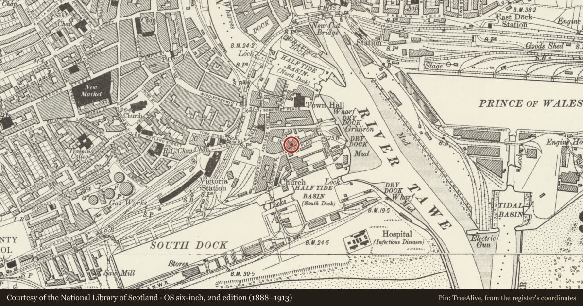
5 historical maps cover this location, the earliest the 1636 map "Cornubia : Devonia, Somersetus, Dorcestria, Wiltonia, Glocestria ..." (David Rumsey Map Collection, Stanford Libraries).
Historical maps covering this location
- 1636 · Cornubia : Devonia, Somersetus, Dorcestria, Wiltonia, Glocestria ... (David Rumsey Map Collection, Stanford Libraries)
- 1637 · The fourth table of England. Cornub. Devonia, Somerset etc. (David Rumsey Map Collection, Stanford Libraries)
- 1865 · England and Wales. England No. 6. (David Rumsey Map Collection, Stanford Libraries)
- 1891 · Sheet 10. Ordnance Survey of England and Wales. . (David Rumsey Map Collection, Stanford Libraries)
- 1897 · 247 Swansea (Hills) (David Rumsey Map Collection, Stanford Libraries)
Cadw's description
Location
End of Georgian terrace with former Assembly Rooms adjoining to right.
History
Early C20 Edwardian classicism, influence of Aston Webb.
Exterior
Tall, symmetrical 3 storey and basement, 5-bay façade. Red brick facings, Bath stone dressings, Portland stone ground floor.
Bracket cornice and solid parapet, cornices to end stacks. Rusticated end pilasters with swagged tablets. Lugged 2nd floor windows, with husk drops, linked by aprons to open segmental pediments on brackets over keystone architraves of 1st floor windows; wider centre surround with volute supports. Sashes with small-pane glazing.
Aprons to deep frieze over ground floor cornice breaking forward at centre doorpiece. Doric porch with triglyph frieze incorporating name tablet; arched entrance with volute keyblock, traceried and double 3-panel doors. Cavetto splays to arched and keyblocked side windows.
Good original area railings with gate to rusticated basement.
Hipped roof to partly white tiled and rendered rear range running back to classical frontage on Pier Street. 3 storey, 5-window brick elevation with freestone cornice, parapet and window surrounds with aprons. Arched central doorway with curved hood on brackets etc.
Reason for designation
Group value.
Nearby in the register
- Pembroke BuildingsCommercialunder 1 mi
- Former Assembly RoomsRecreationalunder 1 mi
- 6 Cambrian PlaceDomesticunder 1 mi
- 7 Cambrian PlaceDomesticunder 1 mi
Other entries of the same register within about three miles of this one, by straight line.