Cof Cymru: National Historic Assets of Wales · Wales
Former Wesley Methodist Church
Town, Merthyr Tydfil, Wales
A Grade II listed building in Pontmorlais, Town, Merthyr Tydfil, designated on 13 January 1988.
The record
- Designation
- Listed building, Grade II
- Broad class
- Religious, Ritual and Funerary
- Date of designation
- 13 January 1988
- Locality
- Pontmorlais
- Community
- Town
- Unitary authority
- Merthyr Tydfil
- Country
- Wales
- Coordinates
- 51.74908, -3.37726
- Cadw reference
- 11454
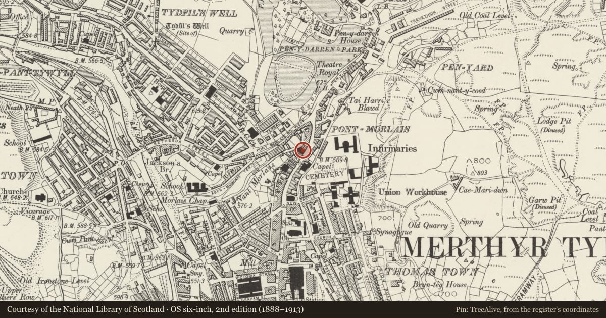
Slide toward Today to fade the historical sheet and see the modern map underneath.
David Rumsey Map Collection, Stanford LibrariesDavid Rumsey Map Collection, Stanford LibrariesDavid Rumsey Map Collection, Stanford LibrariesDavid Rumsey Map Collection, Stanford LibrariesDavid Rumsey Map Collection, Stanford Libraries
5 historical maps cover this location, the earliest the 1636 map "Cornubia : Devonia, Somersetus, Dorcestria, Wiltonia, Glocestria ..." (David Rumsey Map Collection, Stanford Libraries).
Historical maps covering this location
- 1636 · Cornubia : Devonia, Somersetus, Dorcestria, Wiltonia, Glocestria ... (David Rumsey Map Collection, Stanford Libraries)
- 1637 · The fourth table of England. Cornub. Devonia, Somerset etc. (David Rumsey Map Collection, Stanford Libraries)
- 1830 · V.3:11-15:XV. Britisches Reich. A. Kon: England. b. Frstenthum Wales: Shire: 37-40 (David Rumsey Map Collection, Stanford Libraries)
- 1895 · Sheet 11. Ordnance Survey of England and Wales. (David Rumsey Map Collection, Stanford Libraries)
- 1898 · 231 Merthyr Tydfil (Hills) (David Rumsey Map Collection, Stanford Libraries)
Cadw's description
Location
Set back slightly to right of Nos 12 and 12A Pontmorlais.
Exterior
1862 date. Imposing 3-bay late classical facade with central pedimented and pilastered bay. Channelled rustication to ashlar ground-floor, cement render above (some detailing simplified). Frieze inscribed "WESLEY CHAPEL". Pilastered, 3-light, stepped centre window with moulded architraves and frond lunettes, marginal glazing-bars. Scallop-shell lunettes over arched ground-floor windows with aprons. Double centre doors under radiating fanlight. Rubble flank elevation with brickwork dressings, slate roof.
Interior
Interior recently subdivided.
Nearby in the register
- Gates & Gatepiers at Entry to Zoar ChapelReligious, Ritual and Funeraryunder 1 mi
- Zoar Chapel (Welsh Congregational)Religious, Ritual and Funeraryunder 1 mi
- District Education Office of Mid-Glamorgan County Council (YMCA)Commercialunder 1 mi
- 14 New Castle StreetDomesticunder 1 mi
Other entries of the same register within about three miles of this one, by straight line.