Cof Cymru: National Historic Assets of Wales · Wales
The Lodge
Cynwyl Gaeo, Carmarthenshire, Wales
A Grade II listed building in Pumpsaint, Cynwyl Gaeo, Carmarthenshire, designated on 14 January 1988.
The record
- Designation
- Listed building, Grade II
- Broad class
- Domestic
- Date of designation
- 14 January 1988
- Locality
- Pumpsaint
- Community
- Cynwyl Gaeo
- Unitary authority
- Carmarthenshire
- Country
- Wales
- Coordinates
- 52.04690, -3.96045
- Cadw reference
- 11131
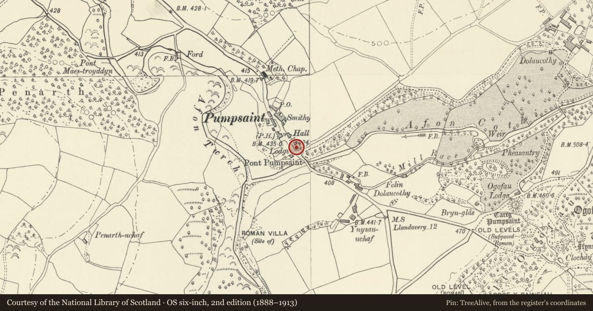
Slide toward Today to fade the historical sheet and see the modern map underneath.
David Rumsey Map Collection, Stanford LibrariesDavid Rumsey Map Collection, Stanford LibrariesDavid Rumsey Map Collection, Stanford LibrariesDavid Rumsey Map Collection, Stanford LibrariesDavid Rumsey Map Collection, Stanford Libraries
5 historical maps cover this location, the earliest the 1608 map "(13) Cambriae Typus." (David Rumsey Map Collection, Stanford Libraries).
Historical maps covering this location
- 1608 · (13) Cambriae Typus. (David Rumsey Map Collection, Stanford Libraries)
- 1830 · V.3:11-15:XV. Britisches Reich. A. Kon: England. b. Frstenthum Wales: Shire: 37-40 (David Rumsey Map Collection, Stanford Libraries)
- 1860 · 41. Caermathen. (David Rumsey Map Collection, Stanford Libraries)
- 1891 · Sheet 10. Ordnance Survey of England and Wales. . (David Rumsey Map Collection, Stanford Libraries)
- 1901 · Sheet 14. (David Rumsey Map Collection, Stanford Libraries)
Cadw's description
Location
Situated in village centre on E side of A482 at entrance of lane to Dolaucothi Home Farm.
History
Formerly the lodge to Dolaucothi, home of the Johnes family since the early C16. Early/mid C19 structure with late C19/early C20 gabled upper floor; originally the house probably had a hipped roof. Shown on 1841 Tithe Map.
Exterior
Rubble built, squared quoins: the upper masonry is of angular shaley ironstone. Slate roof, wooden soffits, decorative bargeboards. Central renewed brick chimney stack to ridge. Gabled front. Two upper late C19 2-light latticed leaded casements, concrete lintels. Two wide early/mid C19 3-light casements with cast iron latticed glazing to ground floor, Tudor labels. Central C20 door, late C19 open timber porch with stop- chamfered posts, elliptical head, flat wooden pendants to centre and sides. Right elevation with C20 door to left, concrete lintel. Two light casement to right, cast iron latticed panes, timber lintel. Left elevation with early/mid C19 3-light casement to left, cast iron latticed panes, similar window to right reduced to two lights. Both have Tudor labels. Rear with two upper 2-light leaded windows as front. Small ground floor window with metal gauze.
Reason for designation
Prominent picturesque C19 lodge in good village setting.
Nearby in the register
- Village HallRecreationalunder 1 mi
- War Memorial Gates and Railings to the Village HallCommemorativeunder 1 mi
- Former Carthouse and Stable opposite Dolaucothi ArmsDomesticunder 1 mi
- Pumpsaint Roman FortFortunder 1 mi
Other entries of the same register within about three miles of this one, by straight line.