Cof Cymru: National Historic Assets of Wales · Wales
Mount Pleasant
Llandeilo, Carmarthenshire, Wales
A Grade II listed building in Llandeilo, Carmarthenshire, designated on 24 June 1991.
The record
- Designation
- Listed building, Grade II
- Broad class
- Domestic
- Date of designation
- 24 June 1991
- Community
- Llandeilo
- Unitary authority
- Carmarthenshire
- Country
- Wales
- Coordinates
- 51.88194, -3.99165
- Cadw reference
- 11055
Slide toward Today to fade the historical sheet and see the modern map underneath.
David Rumsey Map Collection, Stanford LibrariesDavid Rumsey Map Collection, Stanford LibrariesDavid Rumsey Map Collection, Stanford LibrariesDavid Rumsey Map Collection, Stanford LibrariesDavid Rumsey Map Collection, Stanford Libraries
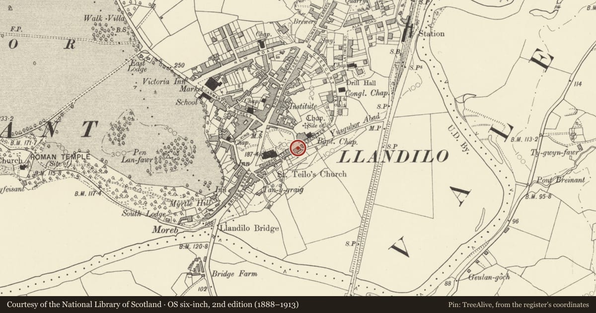
5 historical maps cover this location, the earliest the 1860 map "41. Caermathen." (David Rumsey Map Collection, Stanford Libraries).
Historical maps covering this location
- 1860 · 41. Caermathen. (David Rumsey Map Collection, Stanford Libraries)
- 1891 · Sheet 10. Ordnance Survey of England and Wales. . (David Rumsey Map Collection, Stanford Libraries)
- 1898 · 212 Llandovery (Outline) (David Rumsey Map Collection, Stanford Libraries)
- 1898 · 212 Llandovery (Hills) (David Rumsey Map Collection, Stanford Libraries)
- 1901 · Sheet 14. (David Rumsey Map Collection, Stanford Libraries)
Cadw's description
Location
On the street line alongside Ysgubor Abad where Church Street meets Abbey Terrace and Crescent Road.
Exterior
1770? Two-storey, 3 window, double pile house. Colourwashed rubble masonry. Steeply pitched slate roof, modillion eaves cornice to front, close verges. Later? rendered stacks.
12 pane sash windows to lst floor, slightly cambered stone voussoirs. Similar to ground floor flanking entrance. Central round arched doorway, rendered surround. Flat roofed open porch on rectangular timber porch (formerly trellised). Plain fanlight over 6 panelled door, top panels glazed.
Later, probably C20, railed forecourt.
Later, 2 storey, l window projection to left end elevation. Modern door to right on house, Victorian sash window, sidebar glazing, to left. Attic window to rear range.
Rear elevation slate hung, modern fenestration.
Yard wall facing Ysgubor Abad has re-set slate datestone over broad modern garage doors. Date l770 set within fleur-de-lis border.
Nearby in the register
- Stepney HouseDomesticunder 1 mi
- Stretch of Walling & Archways between Nos.5 & 7Domesticunder 1 mi
- Well (including churchyard Wall for 10m West and 20m East)Religious, Ritual and Funeraryunder 1 mi
- 5 Abbey TerraceDomesticunder 1 mi
Other entries of the same register within about three miles of this one, by straight line.