Cof Cymru: National Historic Assets of Wales · Wales
Stepney House
Llandeilo, Carmarthenshire, Wales
A Grade II listed building in Llandeilo, Carmarthenshire, designated on 24 June 1991.
The record
- Designation
- Listed building, Grade II
- Broad class
- Domestic
- Date of designation
- 24 June 1991
- Community
- Llandeilo
- Unitary authority
- Carmarthenshire
- Country
- Wales
- Coordinates
- 51.88192, -3.99177
- Cadw reference
- 11054
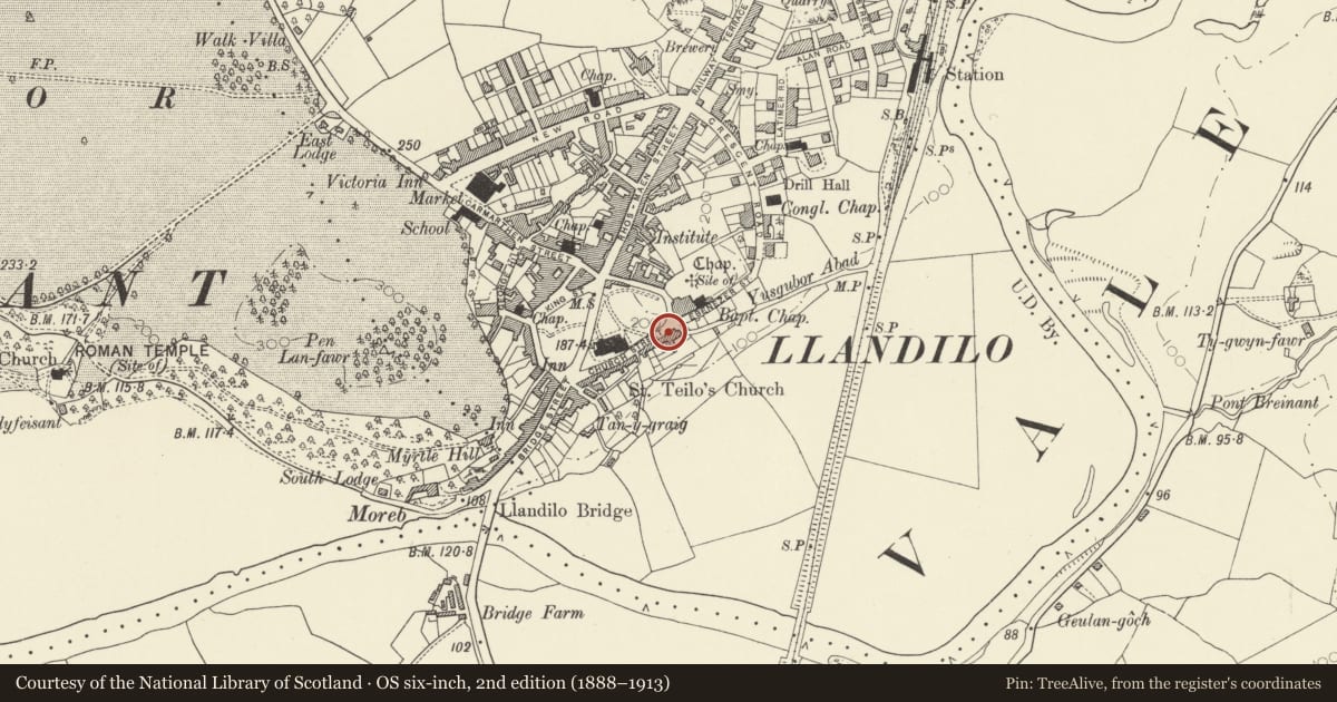
Slide toward Today to fade the historical sheet and see the modern map underneath.
David Rumsey Map Collection, Stanford LibrariesDavid Rumsey Map Collection, Stanford LibrariesDavid Rumsey Map Collection, Stanford LibrariesDavid Rumsey Map Collection, Stanford LibrariesDavid Rumsey Map Collection, Stanford Libraries
5 historical maps cover this location, the earliest the 1860 map "41. Caermathen." (David Rumsey Map Collection, Stanford Libraries).
Historical maps covering this location
- 1860 · 41. Caermathen. (David Rumsey Map Collection, Stanford Libraries)
- 1891 · Sheet 10. Ordnance Survey of England and Wales. . (David Rumsey Map Collection, Stanford Libraries)
- 1898 · 212 Llandovery (Outline) (David Rumsey Map Collection, Stanford Libraries)
- 1898 · 212 Llandovery (Hills) (David Rumsey Map Collection, Stanford Libraries)
- 1901 · Sheet 14. (David Rumsey Map Collection, Stanford Libraries)
Cadw's description
Location
On the street line stepped down from No 24 adjoining. Near the junction with Abbey Terrace and Crescent Road.
Exterior
Early Cl9. 2 storey and basement, 3 window house. Cement render on rubble. Gently pitched slate roofs, swept plain eaves. Rendered stacks.
l2 pane sash windows to lst floor flank dummy window to centre. Similar windows to ground floor flank central round arched doorway. Flat hood over simple doorcase, thin pilasters. Deep panelled reveals and soffit, semi-circular fanlight over 6 panel door.
Shallow railed area. Small paned sliding sashes to basement windows.
Reason for designation
Group value with No 24 adjoining.
Nearby in the register
- Mount PleasantDomesticunder 1 mi
- Well (including churchyard Wall for 10m West and 20m East)Religious, Ritual and Funeraryunder 1 mi
- Stretch of Walling & Archways between Nos.5 & 7Domesticunder 1 mi
- 5 Abbey TerraceDomesticunder 1 mi
Other entries of the same register within about three miles of this one, by straight line.