Cof Cymru: National Historic Assets of Wales · Wales
Bandstand in Penlan Park
Llandeilo, Carmarthenshire, Wales
A Grade II listed building in Llandeilo, Carmarthenshire, designated on 24 June 1991.
The record
- Designation
- Listed building, Grade II
- Broad class
- Gardens, Parks and Urban Spaces
- Date of designation
- 24 June 1991
- Community
- Llandeilo
- Unitary authority
- Carmarthenshire
- Country
- Wales
- Coordinates
- 51.88153, -3.99580
- Cadw reference
- 11048
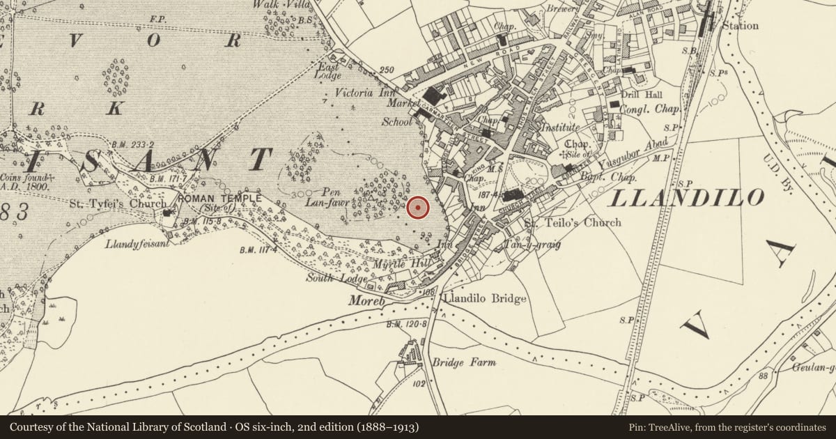
Slide toward Today to fade the historical sheet and see the modern map underneath.
David Rumsey Map Collection, Stanford LibrariesDavid Rumsey Map Collection, Stanford LibrariesDavid Rumsey Map Collection, Stanford LibrariesDavid Rumsey Map Collection, Stanford LibrariesDavid Rumsey Map Collection, Stanford Libraries
5 historical maps cover this location, the earliest the 1860 map "41. Caermathen." (David Rumsey Map Collection, Stanford Libraries).
Historical maps covering this location
- 1860 · 41. Caermathen. (David Rumsey Map Collection, Stanford Libraries)
- 1891 · Sheet 10. Ordnance Survey of England and Wales. . (David Rumsey Map Collection, Stanford Libraries)
- 1898 · 212 Llandovery (Outline) (David Rumsey Map Collection, Stanford Libraries)
- 1898 · 212 Llandovery (Hills) (David Rumsey Map Collection, Stanford Libraries)
- 1901 · Sheet 14. (David Rumsey Map Collection, Stanford Libraries)
Cadw's description
Location
Situated at the highest point of the park below Pen-lan-fawr coppice.
Exterior
Early C20 octagonal bandstand. Polygonal tiled roof with swept eaves, finial. Eight cast iron columns, scrolled brackets over foliate capitals, bulbous bases. Renewed ironwork railings. Octagonal brick stepped plinth.
Nearby in the register
- 9 George HillDomesticunder 1 mi
- 8 George HillDomesticunder 1 mi
- 7 George HillDomesticunder 1 mi
- 6 George HillDomesticunder 1 mi
Other entries of the same register within about three miles of this one, by straight line.