Cof Cymru: National Historic Assets of Wales · Wales
Myrtle Hill
Llandeilo, Carmarthenshire, Wales
A Grade II listed building in Llandeilo, Carmarthenshire, designated on 24 June 1991.
The record
- Designation
- Listed building, Grade II
- Broad class
- Domestic
- Date of designation
- 24 June 1991
- Community
- Llandeilo
- Unitary authority
- Carmarthenshire
- Country
- Wales
- Coordinates
- 51.88063, -3.99525
- Cadw reference
- 11038
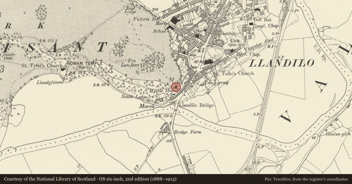
Slide toward Today to fade the historical sheet and see the modern map underneath.
David Rumsey Map Collection, Stanford LibrariesDavid Rumsey Map Collection, Stanford LibrariesDavid Rumsey Map Collection, Stanford LibrariesDavid Rumsey Map Collection, Stanford LibrariesDavid Rumsey Map Collection, Stanford Libraries
5 historical maps cover this location, the earliest the 1860 map "41. Caermathen." (David Rumsey Map Collection, Stanford Libraries).
Historical maps covering this location
- 1860 · 41. Caermathen. (David Rumsey Map Collection, Stanford Libraries)
- 1891 · Sheet 10. Ordnance Survey of England and Wales. . (David Rumsey Map Collection, Stanford Libraries)
- 1898 · 212 Llandovery (Outline) (David Rumsey Map Collection, Stanford Libraries)
- 1898 · 212 Llandovery (Hills) (David Rumsey Map Collection, Stanford Libraries)
- 1901 · Sheet 14. (David Rumsey Map Collection, Stanford Libraries)
Cadw's description
Location
Located at the end of the terrace down a narrow lane.
Exterior
Ca 1790. Two storey, 3 window house. Colourwashed roughcast on rubble with plinth. Moderately pitched slate roof, oversailing eaves, deep verges, exposed purlins. Projecting end stacks, shouldered to right end.
9 pane sashes (6 over 3) to first floor windows, deep reveals. 12 pane sashes to ground floor, deep reveals cambered heads. Central doorway. Broad 6 fielded panel door, (upper 2 new glazed). Later outhouse to right end. Colourwased rubble masonry. Assymetric pitched slate roof. Single modern 4 pane window to right, stone voussoirs. Doorway to left, 2 pane rectangular fanlight over plank door.
Cartshed to left end. Colourwashed rubble masonry. Moderately pitched stone slate roof. Single loft window, 9 pane sash (6 over 3). Broad cart entry below, stone voussoirs, plank double doors. Former stable adjoins rear. Continuous outshot to rear of house. Three, 2 light casement windows. Back door of outhouse at extreme left.
Nearby in the register
- 21 Bridge StreetDomesticunder 1 mi
- Llandeilo Bridge (including Causeway)Transportunder 1 mi
- Bandstand in Penlan ParkGardens, Parks and Urban Spacesunder 1 mi
- The King's HeadCommercialunder 1 mi
Other entries of the same register within about three miles of this one, by straight line.