Cof Cymru: National Historic Assets of Wales · Wales
Llandeilo Bridge (including Causeway)
Llandeilo, Carmarthenshire, Wales
A Grade II* listed building in (partly in Dyffryn Cennen community), Llandeilo, Carmarthenshire, designated on 14 March 1966.
The record
- Designation
- Listed building, Grade II*
- Broad class
- Transport
- Date of designation
- 14 March 1966
- Locality
- (partly in Dyffryn Cennen community)
- Town
- Llandeilo
- Community
- Llandeilo
- Unitary authority
- Carmarthenshire
- Country
- Wales
- Coordinates
- 51.87971, -3.99523
- Cadw reference
- 11040
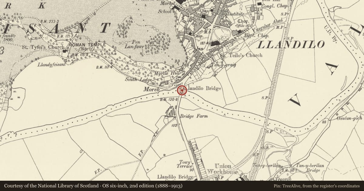
Slide toward Today to fade the historical sheet and see the modern map underneath.
David Rumsey Map Collection, Stanford LibrariesDavid Rumsey Map Collection, Stanford LibrariesDavid Rumsey Map Collection, Stanford LibrariesDavid Rumsey Map Collection, Stanford LibrariesDavid Rumsey Map Collection, Stanford Libraries
5 historical maps cover this location, the earliest the 1860 map "41. Caermathen." (David Rumsey Map Collection, Stanford Libraries).
Historical maps covering this location
- 1860 · 41. Caermathen. (David Rumsey Map Collection, Stanford Libraries)
- 1891 · Sheet 10. Ordnance Survey of England and Wales. . (David Rumsey Map Collection, Stanford Libraries)
- 1898 · 212 Llandovery (Outline) (David Rumsey Map Collection, Stanford Libraries)
- 1898 · 212 Llandovery (Hills) (David Rumsey Map Collection, Stanford Libraries)
- 1901 · Sheet 14. (David Rumsey Map Collection, Stanford Libraries)
Cadw's description
Location
Spanning the River Towy and linking the town with Ffairfach.
History
A substantial road bridge of 1848 by W Williams of Llandeilo replacing an earlier bridge downstream. Work supervised by E Haycock of Shrewsbury. Total cost of £22,000, original estimate being £6,000.
Exterior
Twin carriageway stone bridge. Single graceful 145 ft wide depressed arch with stepped freestone voussoirs. Coursed squared rubble masonry. 2 order buttresses at springing points rise through parapet. Further buttresses along long approach causeway from Ffairfach and up Bridge Street. Also revetment wall with steps down to river to W along lower end of Bridge Street. Freestone parapet over string course with domed capstones on bridge, rubble parapet over string course with ridged parapet to causeways and retaining walls.
Further depressed flood arch through approach causeway from Ffairfach, flanked by buttresses.
Later Bronze commemoration plaque with depiction of old bridge to W parapet of bridge.
Nearby in the register
- Llandeilo Bridge (including causeways) (partly in Llandeilo community)Transportunder 1 mi
- 21 Bridge StreetDomesticunder 1 mi
- Myrtle HillDomesticunder 1 mi
- 25 Bridge StreetCommercialunder 1 mi
Other entries of the same register within about three miles of this one, by straight line.