Cof Cymru: National Historic Assets of Wales · Wales
The Pier including Parallel Slipway
New Quay, Ceredigion, Wales
A Grade II listed building in New Quay, Ceredigion, designated on 5 May 1975.
The record
- Designation
- Listed building, Grade II
- Broad class
- Maritime
- Date of designation
- 5 May 1975
- Locality
- New Quay
- Community
- New Quay
- Unitary authority
- Ceredigion
- Country
- Wales
- Coordinates
- 52.21599, -4.35687
- Cadw reference
- 10814
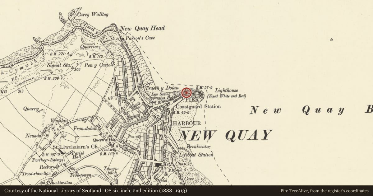
Slide toward Today to fade the historical sheet and see the modern map underneath.
David Rumsey Map Collection, Stanford LibrariesDavid Rumsey Map Collection, Stanford LibrariesDavid Rumsey Map Collection, Stanford LibrariesDavid Rumsey Map Collection, Stanford LibrariesDavid Rumsey Map Collection, Stanford Libraries
5 historical maps cover this location, the earliest the 1608 map "(13) Cambriae Typus." (David Rumsey Map Collection, Stanford Libraries).
Historical maps covering this location
- 1608 · (13) Cambriae Typus. (David Rumsey Map Collection, Stanford Libraries)
- 1830 · V.3:11-15:XV. Britisches Reich. A. Kon: England. b. Frstenthum Wales: Shire: 37-40 (David Rumsey Map Collection, Stanford Libraries)
- 1848 · 57. Tregaron, SW Quad. (David Rumsey Map Collection, Stanford Libraries)
- 1901 · Sheet 14. (David Rumsey Map Collection, Stanford Libraries)
- 1919 · Sheet 78. Lampeter. (David Rumsey Map Collection, Stanford Libraries)
Cadw's description
Location
Situated enclosing N side of New Quay harbour.
History
1835.
Exterior
Pier and quay built by Daniel Beynon, modifying plans produced in 1820 by John Rennie. Massive squared rubble blocks, partly replaced with concrete on sloping outer face after 1938 storm damage. The pier is curving and in two high steps, the lower quay wall with slightly battered face and four inset flights of stone steps, then a broad stone flagged deck before the high raking upper part, also with four inset flights of steps and capped by upper walkway and N side heavy stone parapet. At end of upper deck there was a 'pepperpot' lighthouse built 1859 after the destruction of an 1839 predecessor in the 'Royal Charter' storm and itself wrecked in the 1938 storm. In front of the Pier Building is a broad stone slipway running parallel to the Pier.
Reason for designation
Listed as the visual focus of New Quay and, historically, the origin of the town's prosperity as a port.
Nearby in the register
- The Pier Building, the PierCommercialunder 1 mi
- The Penwig HotelDomesticunder 1 mi
- The GlynDomesticunder 1 mi
- The Captains TableCommercialunder 1 mi
Other entries of the same register within about three miles of this one, by straight line.