Cof Cymru: National Historic Assets of Wales · Wales
Fedw Fawr
Llangeitho, Ceredigion, Wales
A Grade II listed building in Capel Betws Lleucu, Tregaron, Llangeitho, Ceredigion, designated on 17 March 1992.
The record
- Designation
- Listed building, Grade II
- Broad class
- Domestic
- Date of designation
- 17 March 1992
- Locality
- Capel Betws Lleucu
- Town
- Tregaron
- Community
- Llangeitho
- Unitary authority
- Ceredigion
- Country
- Wales
- Coordinates
- 52.20471, -4.03710
- Cadw reference
- 10738
Slide toward Today to fade the historical sheet and see the modern map underneath.
David Rumsey Map Collection, Stanford LibrariesDavid Rumsey Map Collection, Stanford LibrariesDavid Rumsey Map Collection, Stanford LibrariesDavid Rumsey Map Collection, Stanford LibrariesDavid Rumsey Map Collection, Stanford Libraries
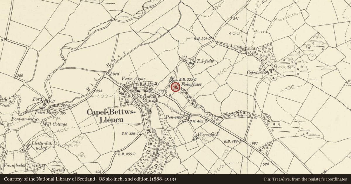
5 historical maps cover this location, the earliest the 1608 map "(13) Cambriae Typus." (David Rumsey Map Collection, Stanford Libraries).
Historical maps covering this location
- 1608 · (13) Cambriae Typus. (David Rumsey Map Collection, Stanford Libraries)
- 1830 · V.3:11-15:XV. Britisches Reich. A. Kon: England. b. Frstenthum Wales: Shire: 37-40 (David Rumsey Map Collection, Stanford Libraries)
- 1899 · 195 Lampeter (Hills) (David Rumsey Map Collection, Stanford Libraries)
- 1901 · Sheet 14. (David Rumsey Map Collection, Stanford Libraries)
- 1919 · Sheet 78. Lampeter. (David Rumsey Map Collection, Stanford Libraries)
Cadw's description
Location
Situated some 300m E of Betws Lleucu church, set back on E side of road to Llangeitho. Built into a rock on a platform site with hillside rising steeply to rear.
History
C17 to C19 house. C17 single-storey and attic building aligned N-S, altered in early C18 and greatly enlarged in earlier C19 by addition of 2-storey range running E-W. Said to have been altered ca1890, extended to E 1910. Modern restoration.
Marked on a 1791 map as owned by David Davies, and on the 1845 Betws Lleucu Tithe Map as being a holding of approximately 33.2 hectares (83 acres), owned by the Reverend John Jones and occupied by Margaret Jones.
Exterior
Colourwashed rubble stone with slate roofs. Modern brick right end stack, massive C17 stack to left front with weathercoursing and stone end stack to rear wing. Two-storey, three-window N front with wide bracket eaves. Mostly small-paned sashes and modern louvred shutters. Small tripartite sash windows with stone voussoirs to cambered heads to right. Glazing bars of ground floor window may have been altered. Ground floor left window was similar, altered with 4-pane sash and glazed doorway. Central lean-to porch under 12-pane sash. Modern door with earlier C19 overlight. The large chimney over left window was main chimney of C17 house, and has dove-holes. Whitewashed W end wall . Whitewashed mostly blank rear wall.
C17 SE range has roof swept up to taller earlier C19 front. E side has swept-roof dormer with 12-pane sash over tripartite small sash with timber lintel. Stone end stack. Brick kitchen addition stepped down to E with leaning end chimney. Two-storey, two-window W side has two first floor 12-pane sashes and ground floor left deeply recessed half-glazed door with stone voussoirs to cambered head.
Interior
Thick walls to C17 part. Earlier C19 narrow stair hall. 6-panel door to left into C17 part. Modern ceiling with roughly chamfered beams. Opposite a low boarded door with timber lintel is probably the original main entry opening directly onto the hall to the left of a now lost partition. Chamfered timber beam to the fireplace with smoke window. Modern cooking range. Step up at S towards parlour which has good chimney-breast with voussoirs to square-headed fireplace. Earlier C19 dog-leg stair with deeply scrolled newel. Blocked window in former end wall, remains of earlier C19 panelling.
Upstairs: 5-bay C17 range is ceiled at collar level, collar trusses with lapped collars, partly altered and restored. Unusual notched lapped joints to feet (possibly re-used timbers). Partition removed. C19 part retains slate fireplace with iron grate. 6-panel doors.
Reason for designation
Listed as a house which has special interest for its C17 origins.
Nearby in the register
- Tal-FedwDomesticunder 1 mi
- GlanmarchDomesticunder 1 mi
- Felin FachIndustrialunder 1 mi
- Cilpyll FarmhouseDomesticunder 1 mi
Other entries of the same register within about three miles of this one, by straight line.