Cof Cymru: National Historic Assets of Wales · Wales
The Black Lion Hotel
Cardigan, Ceredigion, Wales
A Grade II listed building in Cardigan, Ceredigion, designated on 14 April 1992.
The record
- Designation
- Listed building, Grade II
- Broad class
- Commercial
- Date of designation
- 14 April 1992
- Community
- Cardigan
- Unitary authority
- Ceredigion
- Country
- Wales
- Coordinates
- 52.08269, -4.66106
- Cadw reference
- 10484
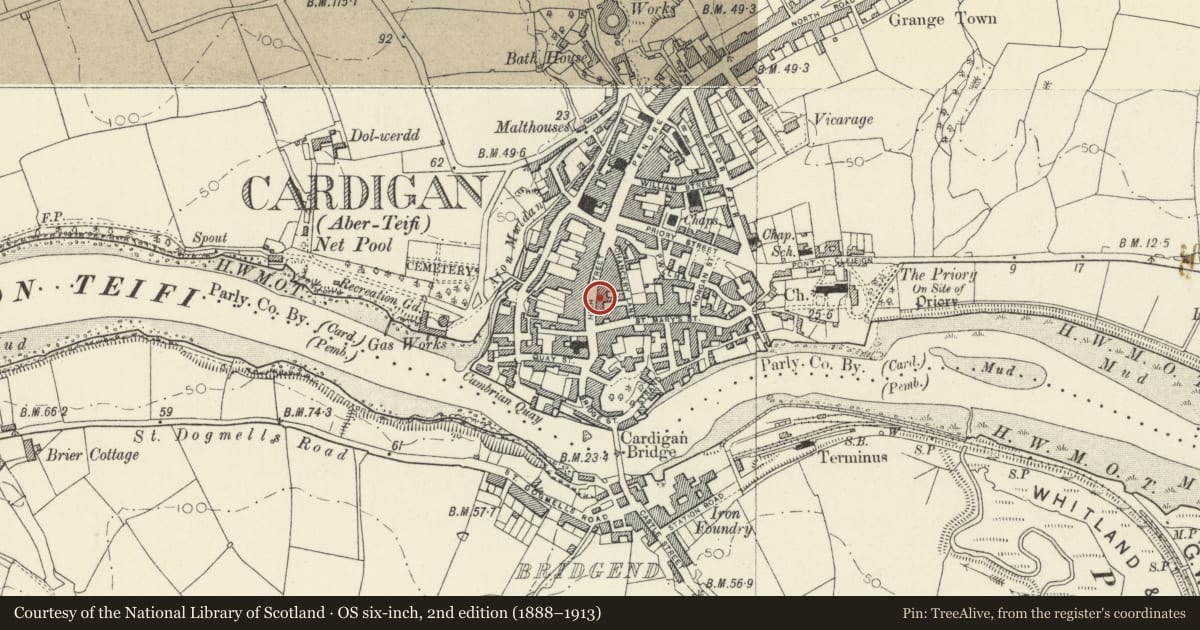
Slide toward Today to fade the historical sheet and see the modern map underneath.
David Rumsey Map Collection, Stanford LibrariesDavid Rumsey Map Collection, Stanford LibrariesDavid Rumsey Map Collection, Stanford LibrariesDavid Rumsey Map Collection, Stanford LibrariesDavid Rumsey Map Collection, Stanford Libraries
5 historical maps cover this location, the earliest the 1608 map "(13) Cambriae Typus." (David Rumsey Map Collection, Stanford Libraries).
Historical maps covering this location
- 1608 · (13) Cambriae Typus. (David Rumsey Map Collection, Stanford Libraries)
- 1637 · Particular description of Wales. Cambria seu Wallia (David Rumsey Map Collection, Stanford Libraries)
- 1830 · V.3:11-15:XV. Britisches Reich. A. Kon: England. b. Frstenthum Wales: Shire: 37-40 (David Rumsey Map Collection, Stanford Libraries)
- 1898 · 193 Cardigan (Hills) (David Rumsey Map Collection, Stanford Libraries)
- 1901 · Sheet 13. (David Rumsey Map Collection, Stanford Libraries)
Cadw's description
Location
Situated on street line opposite Eben's Lane.
History
Later C18 inn. The principal inn of Cardigan from the C18, site of Town Council meetings before Shire Hall was built 1784. The facade was stuccoed in C19, and is the earliest surviving brick front in the town. The porch was rebuilt after vehicle damage.
Exterior
Red brick, Flemish bond with stucco cornice and parapet and slate roof with brick end stacks. Three-storey, 5 window range of sashes with cambered brick heads, 6-pane to second floor, 12-pane to first floor, ground floor sashes replaced by shallow 12-pane C20 bow windows. Centre door with traceried overlight. Slate sills except to ground floor that has C20 brick sills. Door is in C20 rebuilt timber classical porch of 2 Roman Doric columns, the shafts untapered and without bases, pilaster responds, entablature with triglyphs over columns and flat cornice. Two lead downpipes with embossed lions on rainwater heads.
Rear is stone with 2 rear wings, that to south taller with truncated brick stack, that to north with 2 brick corner stacks and arch-headed gable window.
Interior
Interior Ground floor altered, one brick-arched fireplace on south end.
Nearby in the register
- 29 High StreetCommercialunder 1 mi
- 28 High StreetCommercialunder 1 mi
- 10 High StreetCommercialunder 1 mi
- 9 High StreetCommercialunder 1 mi
Other entries of the same register within about three miles of this one, by straight line.