Cof Cymru: National Historic Assets of Wales · Wales
29 High Street
Cardigan, Ceredigion, Wales
A Grade II listed building in Cardigan, Ceredigion, designated on 14 April 1992.
The record
- Designation
- Listed building, Grade II
- Broad class
- Commercial
- Date of designation
- 14 April 1992
- Community
- Cardigan
- Unitary authority
- Ceredigion
- Country
- Wales
- Coordinates
- 52.08286, -4.66109
- Cadw reference
- 10483
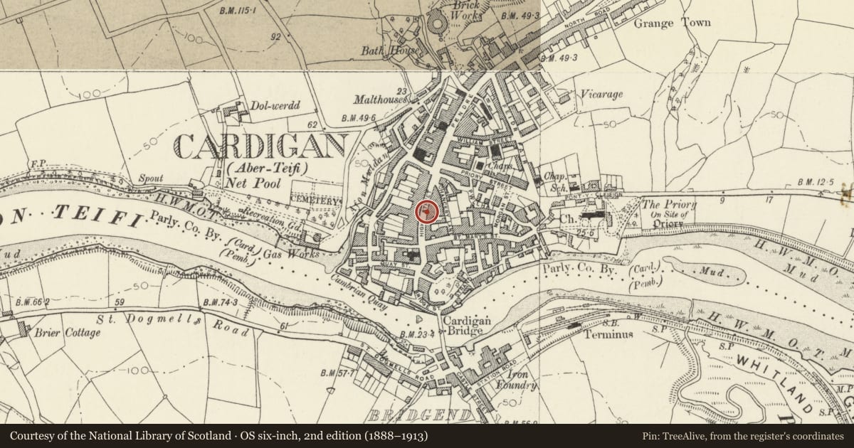
Slide toward Today to fade the historical sheet and see the modern map underneath.
David Rumsey Map Collection, Stanford LibrariesDavid Rumsey Map Collection, Stanford LibrariesDavid Rumsey Map Collection, Stanford LibrariesDavid Rumsey Map Collection, Stanford LibrariesDavid Rumsey Map Collection, Stanford Libraries
5 historical maps cover this location, the earliest the 1608 map "(13) Cambriae Typus." (David Rumsey Map Collection, Stanford Libraries).
Historical maps covering this location
- 1608 · (13) Cambriae Typus. (David Rumsey Map Collection, Stanford Libraries)
- 1637 · Particular description of Wales. Cambria seu Wallia (David Rumsey Map Collection, Stanford Libraries)
- 1830 · V.3:11-15:XV. Britisches Reich. A. Kon: England. b. Frstenthum Wales: Shire: 37-40 (David Rumsey Map Collection, Stanford Libraries)
- 1898 · 193 Cardigan (Hills) (David Rumsey Map Collection, Stanford Libraries)
- 1901 · Sheet 13. (David Rumsey Map Collection, Stanford Libraries)
Cadw's description
Location
Situated on street line immediately north of Black Lion Hotel.
History
Early C19
Exterior
Blue lias rubble stone with slate roof, one truncated brick ridge stack to right and one red brick north end stack. Three-storey, 3-window, 1 plus 2, with first floor 12-pane sashes, hornless, with slate sills and brick heads and similar 6-pane windows above. Flat eaves with paired brackets.
Ground floor retains original carriage arch into Black Lion Yard, right, blue lias voussoirs to broad depressed arch, cut into brickwork of Black Lion. The rest has mid C20 black tiled shopfronts, 3 narrow frontages. Two rear wings.
Formerly stuccoed with ground floor sashes.
Reason for designation
Included for group value with Black Lion, of which it may have been a service range.
Nearby in the register
- 28 High StreetCommercialunder 1 mi
- The Black Lion HotelCommercialunder 1 mi
- Midland BankCommercialunder 1 mi
- 10 High StreetCommercialunder 1 mi
Other entries of the same register within about three miles of this one, by straight line.