Historic Buildings Record · Northern Ireland
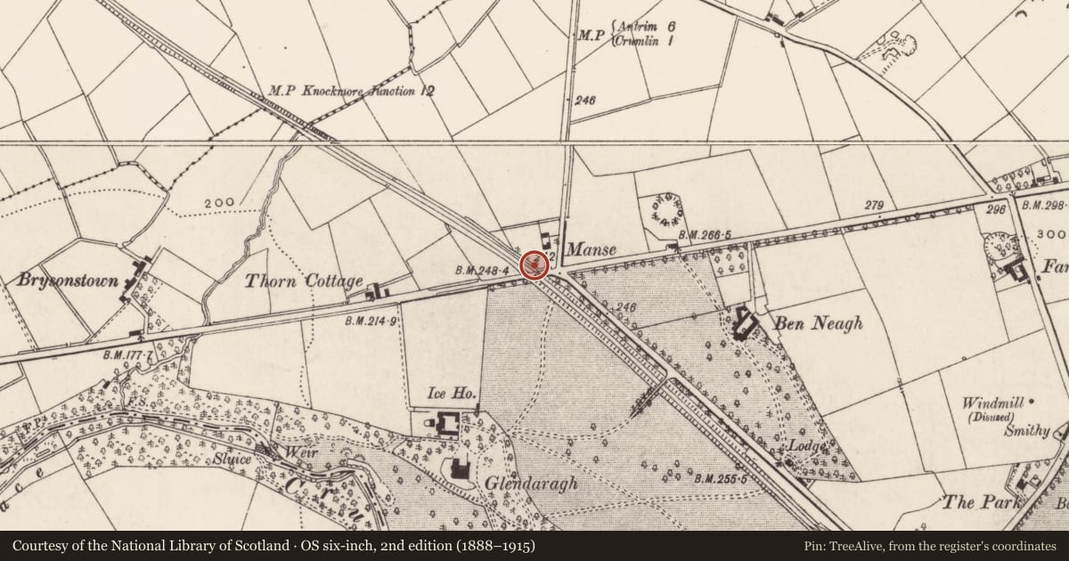
Bridge over railway
Crosshill, Antrim and Newtownabbey, Northern Ireland
The record
- Designation
- Record only (not listed)
- Grade
- Record Only
- Type
- Bridge
- Date of construction
- 1840 - 1859
- Address
- Bridge over railway, Largy Road, Crumlin, Co Antrim
- Townland
- Crosshill
- Council
- Antrim and Newtownabbey
- Country
- Northern Ireland
- Coordinates
- 54.62873, -6.22148
- Date of survey
- 10 May 1999
- HB reference
- HB20/14/026
Slide toward Today to fade the historical sheet and see the modern map underneath.
David Rumsey Map Collection, Stanford LibrariesDavid Rumsey Map Collection, Stanford LibrariesDavid Rumsey Map Collection, Stanford LibrariesDavid Rumsey Map Collection, Stanford Libraries
4 historical maps cover this location, the earliest the 1838 map "Ireland, north sheet." (David Rumsey Map Collection, Stanford Libraries).
Historical maps covering this location
- 1838 · Ireland, north sheet. (David Rumsey Map Collection, Stanford Libraries)
- 1841 · Ireland. (David Rumsey Map Collection, Stanford Libraries)
- 1841 · Scotland (Southern part). XIII (David Rumsey Map Collection, Stanford Libraries)
The Department's description
Exterior description and setting
A single arched masonry skew bridge carrying the main road over a railway line, built of basalt rubble with a segmental archway of shaped rock-faced voussoirs with tooled arrises. Battered faces to abutments, breaking forward from the spandrels. Vaulting of brickwork laid diagonally. Parapet coping of roughly shaped sandstone blocks. Carriageway hump-backed.
SETTING: The bridge stands in a very rural area, with dense growth of trees bordering the embankments, and hedges running up to the parapet ends.
Historical information
Built to carry the main road from Langford Lodge to Belfast over the Dublin and Antrim Junction Railway, a branch line of the Great Northern Railway; date of construction uncertain but it appears on the OS map of 1858.
References – Primary Sources
1. OS Map 1858, Co Antrim 59.
Secondary Sources
1. W.A. McCutcheon, The Industrial Archaeology of Northern Ireland (HMSO, Belfast, 1980), p 110 (but states that the branch line from Knockmore Junction to Antrim was constructed between 1864 and 1871 which is after it appears on the OS map of 1857).
2. IHR 7204.
Criteria for listing: architectural interest
Not listed
Criteria for listing: historic interest
Not listed
Evaluation
This is an example of early Victorian bridge engineering in stone and brick, of unspoiled appearance, but is otherwise not of any special or unusual interest.
Nearby in the register
- Ice house at GlendaraghIce Houseunder 1 mi
- Bridge over railway at GlendaraghBridgeunder 1 mi
- Farm buildings at GlendaraghFarm Buildingsunder 1 mi
- GlendaraghHouseunder 1 mi
Other entries of the same register within about three miles of this one, by straight line.