Historic Buildings Record · Northern Ireland
Queen Victoria post box
Eglish, Armagh City, Banbridge and Craigavon, Northern Ireland
The record
- Designation
- Record only (not listed)
- Grade
- Record Only
- Type
- Post Box
- Date of construction
- 1880 - 1899
- Address
- Queen Victoria post box, In the wall of an outbuilding at, 1 Tarthlogue Road, Eglish, Portadown, Craigavon, Co Armagh
- Townland
- Eglish
- Council
- Armagh City, Banbridge and Craigavon
- Country
- Northern Ireland
- Coordinates
- 54.44896, -6.55313
- Date of survey
- 31 December 2004
- HB reference
- HB15/02/067
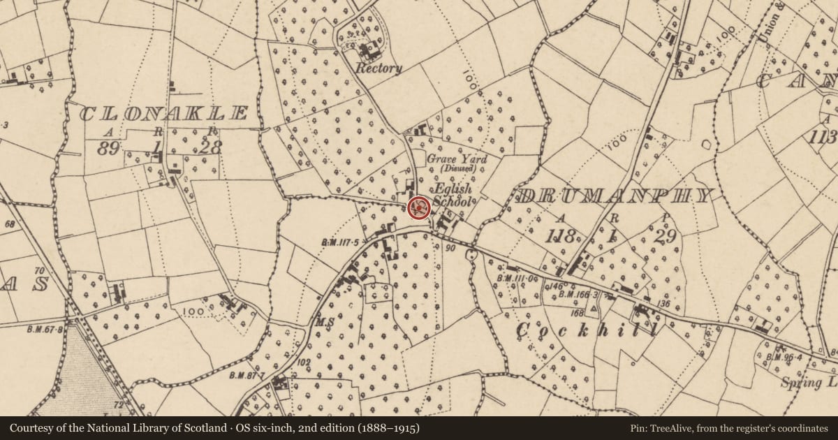
Slide toward Today to fade the historical sheet and see the modern map underneath.
David Rumsey Map Collection, Stanford LibrariesDavid Rumsey Map Collection, Stanford LibrariesDavid Rumsey Map Collection, Stanford LibrariesDavid Rumsey Map Collection, Stanford Libraries
4 historical maps cover this location, the earliest the 1868 map "4. Ireland." (David Rumsey Map Collection, Stanford Libraries).
Historical maps covering this location
- 1868 · 4. Ireland. (David Rumsey Map Collection, Stanford Libraries)
- 1869 · Ireland. (David Rumsey Map Collection, Stanford Libraries)
- 1881 · Ireland to Illustrate the Military Condition of the Country. (David Rumsey Map Collection, Stanford Libraries)
- 1891 · Ireland 16 (David Rumsey Map Collection, Stanford Libraries)
The Department's description
Exterior description and setting
A Queen Victoria post-box made of cast iron set in the wall of a single storey outbuilding. Post-box inscribed 'VR' with a raised crown, and 'T. Allen & Co. London'; identified as post-box no. BT62 37.
SETTING: The building in which the post-box is set stands facing directly onto a minor road in a rural area.
Historical information
Manufactured by T. Allen & Co of London to a standard design in the reign of Queen Victoria (1837-1901) and presumably installed in its current position during the same period. The building in whose wall it is housed appears on the OS map of 1834-5, and is marked as 'School House' on the OS map of 1859.
References – Primary Sources
1. OS Map 1834-5, Co Armagh 5.
2. OS Map 1859, Co Armagh 5.
Criteria for listing: architectural interest
Not listed
Criteria for listing: historic interest
Not listed
Evaluation
This is an example of a wall-mounted post-box of the period of the reign of Queen Victoria which is built into the front of a building of no special architectural or historic interest.
Nearby in the register
- 3 Tarthlogue RoadDemolishedunder 1 mi
- COCKHILL WINDMILLWINDMILLunder 1 mi
- 33 Drumanphy RoadNo type recordedunder 1 mi
- Clontylew Bridge, Clontylew Road, Portadown, Co Armagh BT62 1REBridgeunder 1 mi
Other entries of the same register within about three miles of this one, by straight line.