Historic Buildings Record · Northern Ireland
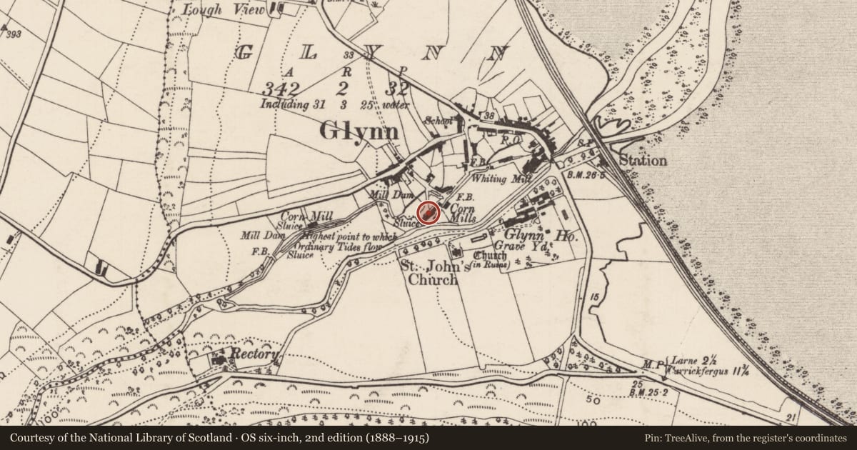
Corn Mills, on opposite side of river from St John's C of I Church
Glynn, Mid and East Antrim, Northern Ireland
The record
- Designation
- Record only (not listed)
- Grade
- Record Only
- Type
- Outbuildings
- Date of construction
- 1820 - 1839
- Address
- Corn Mills, on opposite side of river from St John's C of I Church, Glynn, Larne, Co Antrim
- Townland
- Glynn
- Council
- Mid and East Antrim
- Country
- Northern Ireland
- Coordinates
- 54.82599, -5.81241
- Date of survey
- 04 September 1997
- HB reference
- HB06/06/013
Slide toward Today to fade the historical sheet and see the modern map underneath.
David Rumsey Map Collection, Stanford LibrariesDavid Rumsey Map Collection, Stanford LibrariesDavid Rumsey Map Collection, Stanford LibrariesDavid Rumsey Map Collection, Stanford Libraries
4 historical maps cover this location, the earliest the 1811 map "Ireland." (David Rumsey Map Collection, Stanford Libraries).
Historical maps covering this location
- 1811 · Ireland. (David Rumsey Map Collection, Stanford Libraries)
- 1817 · Ireland. (David Rumsey Map Collection, Stanford Libraries)
- 1824 · Scotland (David Rumsey Map Collection, Stanford Libraries)
- 1825 · Ireland. (David Rumsey Map Collection, Stanford Libraries)
The Department's description
Exterior description and setting
A plain rectangular gabled building, originally a corn mill, but now a playground shelter, with a mill wheel of iron with wooden spokes attached to the south gable. Concrete tiled roof, dry dash finish to walls. Open doorway without doors. It stands in a children’s play-park. Described in the first survey in 1970 as 'A black and white stone building with slated roof; retains a water wheel beside one gable'.
Historical information
Appeared on OS map of 1832.
References - Primary
1. OS Map 1832, Co Antrim 40.
2. Ordnance Survey Memoirs of Ireland: Parishes of County Antrim X, Vol 26 (Belfast, 19940, pp 5, 37-38.
Secondary
1. IHR 6974.
Criteria for listing: architectural interest
Not listed
Criteria for listing: historic interest
Not listed
Evaluation
Much altered former corn mill now of little architectural interest.
Nearby in the register
- St John’s C of I Church,Churchunder 1 mi
- St John’s GraveyardGraveyardunder 1 mi
- 22 Main RoadHouseunder 1 mi
- War MemorialMemorialunder 1 mi
Other entries of the same register within about three miles of this one, by straight line.