Historic Buildings Record · Northern Ireland
Lisardahla
Derry City and Strabane, Northern Ireland
The record
- Designation
- Record only (not listed)
- Grade
- Record Only
- Type
- No type recorded
- Address
- Lisardahla, Ardkill Road, Ardmore, Claudy, County Londonderry
- Council
- Derry City and Strabane
- Country
- Northern Ireland
- Coordinates
- 54.95153, -7.24909
- Date of survey
- 29 January 2014
- HB reference
- HB01/02/034
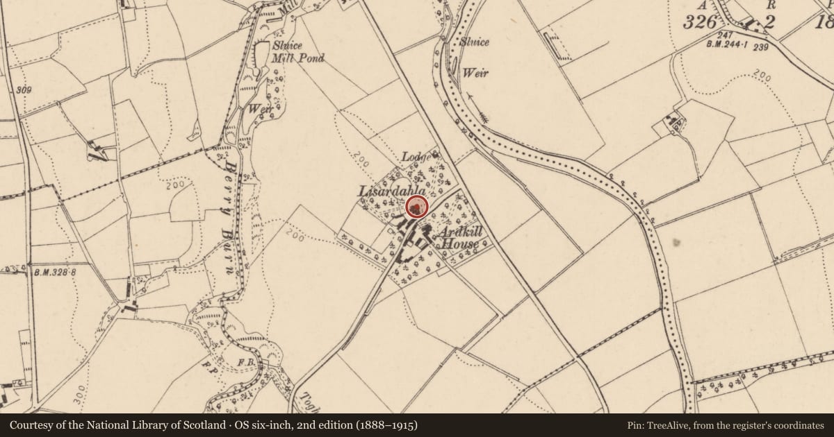
Slide toward Today to fade the historical sheet and see the modern map underneath.
David Rumsey Map Collection, Stanford LibrariesDavid Rumsey Map Collection, Stanford LibrariesDavid Rumsey Map Collection, Stanford LibrariesDavid Rumsey Map Collection, Stanford Libraries
4 historical maps cover this location, the earliest the 1869 map "Ireland." (David Rumsey Map Collection, Stanford Libraries).
Historical maps covering this location
- 1869 · Ireland. (David Rumsey Map Collection, Stanford Libraries)
- 1881 · Ireland to Illustrate the Military Condition of the Country. (David Rumsey Map Collection, Stanford Libraries)
- 1891 · Ireland 16 (David Rumsey Map Collection, Stanford Libraries)
- 1900 · Ireland (David Rumsey Map Collection, Stanford Libraries)
The Department's description
Exterior description and setting
A two-storey three-bay stucco house surrounded by mature woodland in a rural
setting to the west of the River Faughan approximately 1.5 kilometres south-east of Ardmore. Although some features survive, it has loss its roof, internal floors and windows. Some sections of the building have also partially collapsed.
Historical information
N/A
Criteria for listing: architectural interest
Not listed
Criteria for listing: historic interest
Not listed
Evaluation
A two-storey three-bay stucco house surrounded by mature woodland in a rural setting to the west of the River Faughan approximately 1.5 kilometres south-east of Ardmore. Although some features survive, the loss of its roof, internal floors and windows and the partial collapse of some sections compromises its interest; there are other, more complete, examples listed in the District.
General comments
Partial survey only - Although some features survive, the loss of its roof, internal floors and windows and the partial collapse of some sections compromises its interest; there are other, more complete, examples listed in the District.
Nearby in the register
- Knockbrack HouseNo type recordedunder 1 mi
- The CrossNo type recordedunder 1 mi
- GLENKEEN HOUSEHOUSEunder 1 mi
- THE OAKSHOUSE1 mi
Other entries of the same register within about three miles of this one, by straight line.