Sites and Monuments Record · Ireland
Graveyard
Townparks (St. Michael's of Feagh Par.), County Wexford, Ireland
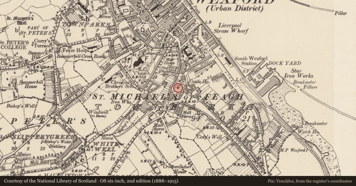
The record
- Townland
- Townparks (St. Michael's of Feagh Par.)
- County
- Wexford
- Country
- Ireland
- First-edition OS map
- Grave Yard
- Latest-edition OS map
- Indicated
- Coordinates
- 52.33320, -6.45831
- SMR number
- WX037-032036-
Slide toward Today to fade the historical sheet and see the modern map underneath.
University Library, Vrije Universiteit AmsterdamUniversity Library, Vrije Universiteit AmsterdamDavid Rumsey Map Collection, Stanford LibrariesDavid Rumsey Map Collection, Stanford Libraries
4 historical maps cover this location, the earliest the 1811 map "Ireland." (David Rumsey Map Collection, Stanford Libraries).
Historical maps covering this location
- 1811 · Ireland. (David Rumsey Map Collection, Stanford Libraries)
- 1891 · Ireland 16 (David Rumsey Map Collection, Stanford Libraries)
- 1904 · Sheet 14, 1904 (University Library, Vrije Universiteit Amsterdam)
- 1911 · Sheet 14, 1911 (University Library, Vrije Universiteit Amsterdam)
This record in the National Monuments Service's Historic Environment Viewer ↗
The National Monuments Service's description
The site of the parish church of St Michael of Feagh (WX037-032017-) is within a raised subrectangular graveyard (dims c. 50m WNW-ESE; c. 30m NNE-SSW) defined by masonry walls. It is located towards the N end of a low NW-SE ridge. There are no visible remains of the church at ground level. Archaeological testing (94E0198) and (94E0202) on the E wall of the graveyard produced evidence of post-medieval burials (Scally 1995), but testing (04E1257) at Faythe Lane c. 60m to the S failed to produce any related material (Stafford 2008). Archaeological testing (18E0460) by Y. Whitty on the W side of Michael St. produced no archaeological finds or features (excavations.ie 2018: 778).
Compiled by: Michael Moore
Date of upload: 19 December, 2012
Amended: 9 Nov. 2020
References
Stafford, E. 2008 Faythe Lane., Wexford. No archaeological significance. In I. Bennett (ed.), Excavations 2005: summary accounts of archaeological excavations in Ireland, 411, No. 1679. Dublin, Wordwell.
Scally, G. 1995 St. Michael's graveyard, Kevin Barry St., Wexford. Burial Site. In I. Bennett (ed.), Excavations 1995: summary accounts of archaeological excavations in Ireland, 84, No. 226. Bray. Wordwell.
Nearby in the register
- Churchunder 1 mi
- Castle - Anglo-Norman masonry castleunder 1 mi
- Churchunder 1 mi
- Architectural featureunder 1 mi
Other entries of the same register within about three miles of this one, by straight line.