Sites and Monuments Record · Ireland
Designed landscape feature
Rochfort Demesne, County Westmeath, Ireland
The record
- Townland
- Rochfort Demesne
- County
- Westmeath
- Country
- Ireland
- First-edition OS map
- Indicated
- Latest-edition OS map
- Hachured
- Coordinates
- 53.47221, -7.37054
- SMR number
- WM026-048----
Slide toward Today to fade the historical sheet and see the modern map underneath.
David Rumsey Map Collection, Stanford LibrariesDavid Rumsey Map Collection, Stanford LibrariesDavid Rumsey Map Collection, Stanford LibrariesDavid Rumsey Map Collection, Stanford Libraries
4 historical maps cover this location, the earliest the 1790 map "Composite: Ireland." (David Rumsey Map Collection, Stanford Libraries).
Historical maps covering this location
- 1790 · Composite: Ireland. (David Rumsey Map Collection, Stanford Libraries)
- 1811 · Ireland. (David Rumsey Map Collection, Stanford Libraries)
- 1869 · Ireland. (David Rumsey Map Collection, Stanford Libraries)
- 1891 · Ireland 16 (David Rumsey Map Collection, Stanford Libraries)
This record in the National Monuments Service's Historic Environment Viewer ↗
The National Monuments Service's description
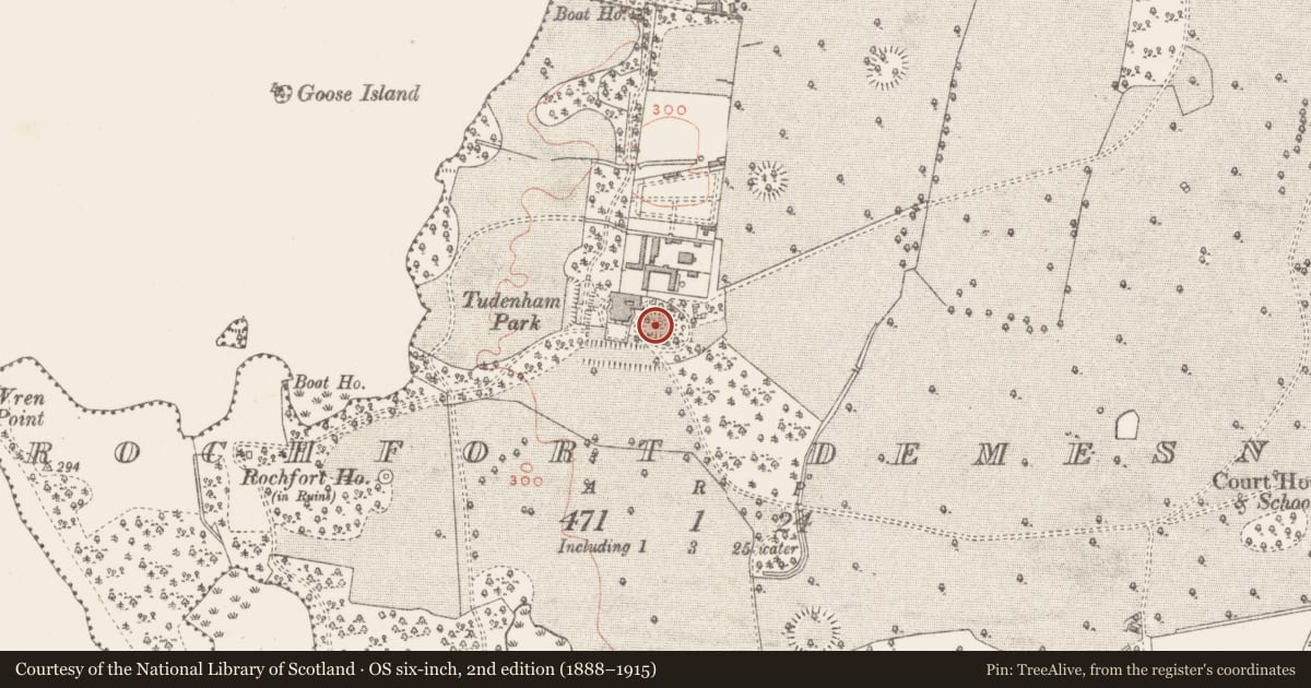
Situated in landscaped garden to immediate rear of Tudenham Park, c. 250m to E of Lough Ennell. Depicted on the revised 1913 ed. OS 25-inch map as a small circular-shaped feature in the centre of a rectangular-shaped sunken garden. A second similar feature is depicted on this map, c. 55m to NE, a third feature lies c. 400m to SW. A fourth similar feature is depicted c. 550m to NE and forms part of the designed landscape of Belvidere House. Monument described in 1978 as a roughly circular-shaped man-made mound of earth and stone (overall diam. 12m). The mound has fairly steep sides (H. c. 1.75m) and a perfectly level flat top with a single tree planted on it. This monument has a fresh and relatively unweathered appearance and for this reason and its location, is likely to be part of a designed landscape associated with Tudenahm Park (formerly Rochfort House) than an earlier antiquity.
Compiled by Alison McQueen, Vera Rahilly and Caimin O’Brien.
Date of upload: 02 October 2019
Nearby in the register
- Ringfort - rathunder 1 mi
- Settlement platformunder 1 mi
- Settlement platformunder 1 mi
- Ringfort - rathunder 1 mi
Other entries of the same register within about three miles of this one, by straight line.