Sites and Monuments Record · Ireland
Castle - motte
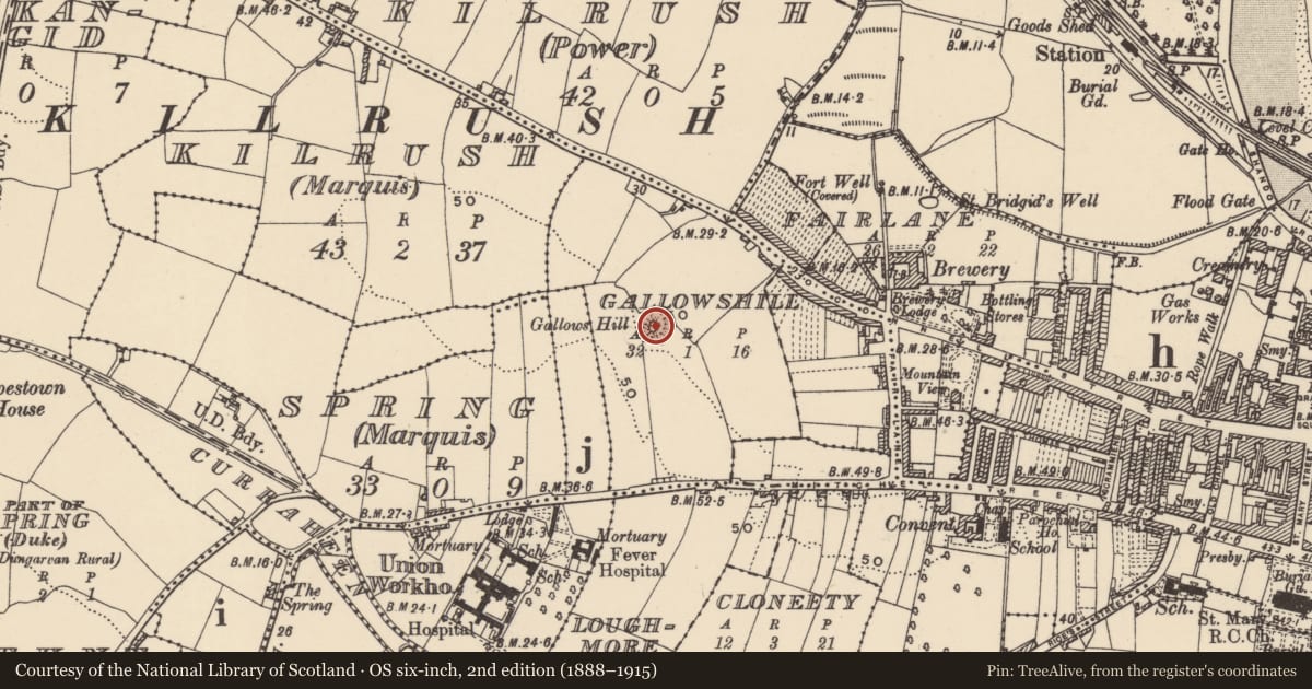
Gallowshill (Decies without Drum By., Kilrush Par.), County Waterford, Ireland
The record
- Townland
- Gallowshill (Decies without Drum By., Kilrush Par.)
- County
- Waterford
- Country
- Ireland
- First-edition OS map
- Hachured
- Latest-edition OS map
- Hachured
- Coordinates
- 52.09061, -7.63390
- SMR number
- WA031-067----
Slide toward Today to fade the historical sheet and see the modern map underneath.
David Rumsey Map Collection, Stanford LibrariesDavid Rumsey Map Collection, Stanford LibrariesDavid Rumsey Map Collection, Stanford LibrariesDavid Rumsey Map Collection, Stanford Libraries
4 historical maps cover this location, the earliest the 1790 map "Composite: Ireland." (David Rumsey Map Collection, Stanford Libraries).
Historical maps covering this location
- 1790 · Composite: Ireland. (David Rumsey Map Collection, Stanford Libraries)
- 1865 · Ireland, (South) Sheet. (David Rumsey Map Collection, Stanford Libraries)
- 1882 · Ireland (southern half). (David Rumsey Map Collection, Stanford Libraries)
- 1891 · Ireland 16 (David Rumsey Map Collection, Stanford Libraries)
This record in the National Monuments Service's Historic Environment Viewer ↗
The National Monuments Service's description
Located on the summit of a hill in a low-lying landscape. A standing stone (WA031-075----/WA031-076----) is located c. 110m to the SW. Flat-topped, grass-covered and subcircular earthen mound (dims. of top 13.5m N-S; 8m E-W; dims. of base 39m N-S; 35m E-W; H 5.5-7m), with slight traces of a fosse (max. Wth c. 15m) SW-NW that might be curtailed elsewhere by a masonry wall 4-7m from the base of the mound. It may be a barrow, although some medieval pottery was recovered in the surrounding area (Tracey 1983a).
Tracey, C. M. (1983a) Gallowshill, Dungarvan: a report on the site and recent finds. Decies, No. 22, 5-14.
The above description is derived from the published 'Archaeological Inventory of County Waterford' (Dublin: Stationery Office, 1999). In certain instances the entries have been revised and updated in the light of recent research.
See attached photographs:
WA031-067----_01 From W
WA031-067----_02 From SW
WA031-067----_03 From NW
Compiled by: Michael Moore
Date of upload: 25 August 2011
Nearby in the register
- Standing stoneunder 1 mi
- Standing stone (present location)under 1 mi
- Rock scribing - folk artunder 1 mi
- Ritual site - holy wellunder 1 mi
Other entries of the same register within about three miles of this one, by straight line.