Sites and Monuments Record · Ireland
Road - class 3 togher
Killoteran, County Waterford, Ireland
The record
- Townland
- Killoteran
- County
- Waterford
- Country
- Ireland
- Latest-edition OS map
- Not indicated
- Coordinates
- 52.23561, -7.21062
- SMR number
- WA017-141002-
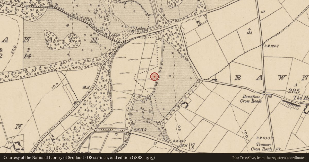
Slide toward Today to fade the historical sheet and see the modern map underneath.
David Rumsey Map Collection, Stanford LibrariesUniversity Library, Vrije Universiteit AmsterdamDavid Rumsey Map Collection, Stanford LibrariesDavid Rumsey Map Collection, Stanford Libraries
4 historical maps cover this location, the earliest the 1790 map "Composite: Ireland." (David Rumsey Map Collection, Stanford Libraries).
Historical maps covering this location
- 1790 · Composite: Ireland. (David Rumsey Map Collection, Stanford Libraries)
- 1882 · Ireland (southern half). (David Rumsey Map Collection, Stanford Libraries)
- 1891 · Ireland 16 (David Rumsey Map Collection, Stanford Libraries)
- 1911 · Sheet 14, 1911 (University Library, Vrije Universiteit Amsterdam)
This record in the National Monuments Service's Historic Environment Viewer ↗
The National Monuments Service's description
Situated in the flood plain of the canalised N-S Ballymoat Stream, c. 14m from its W bank. It was excavated (E3827) by I. Russell during 2007 as part of Killoteran 11. Eight scattered areas of burnt stone in a black soil matrix overlay the circular wattle-lined trough of a fulacht fia (WA017-141001-), and a trackway 4m NW of the trough. The trackway (L 5m ENE-WSW; Wth 2m) consisted of unworked timbers loosely laid on the natural peat but held in position by eight wooden stakes. It produced a C14 date of Cal. BC 1540-1410. (Russell 2009b, 2010b)
Ginn, V. and I. Russell (2011) Killoteran 11, Co. Waterford. in J. Eogan and E. Shee-Twohig (2011) Cois tSiúire – nine thousand years of human activity in the lower Suir valley. Archaeological excavations on the N25 Waterford city bypass, vol. 2, 11-16. NRA road scheme: Monograph 8, Dublin
Russell, I. (2009b) N 25. Waterford bypass alternative route. Archaeological investigation. Contract 1. Final report on the archaeological excavation of Killoteran 11. Ministerial Direction E3827. Unpublished report. Archaeological Consultancy Services.
Russell, I. (2010b) Killoteran 11. Burnt spreads, trackway. in I. Bennett (Ed.) Excavations 2007: summary accounts of excavations in Ireland, 316 No. 1824. Wordwell. Dublin.
Compiled by: Michael Moore
Date of upload: 01 March 2012
Nearby in the register
- Fulacht fiaunder 1 mi
- Fulacht fiaunder 1 mi
- Water mill - vertical-wheeledunder 1 mi
- Excavation - miscellaneousunder 1 mi
Other entries of the same register within about three miles of this one, by straight line.