Sites and Monuments Record · Ireland
Castle - unclassified
Ballinamona, County Waterford, Ireland
The record
- Townland
- Ballinamona
- County
- Waterford
- Country
- Ireland
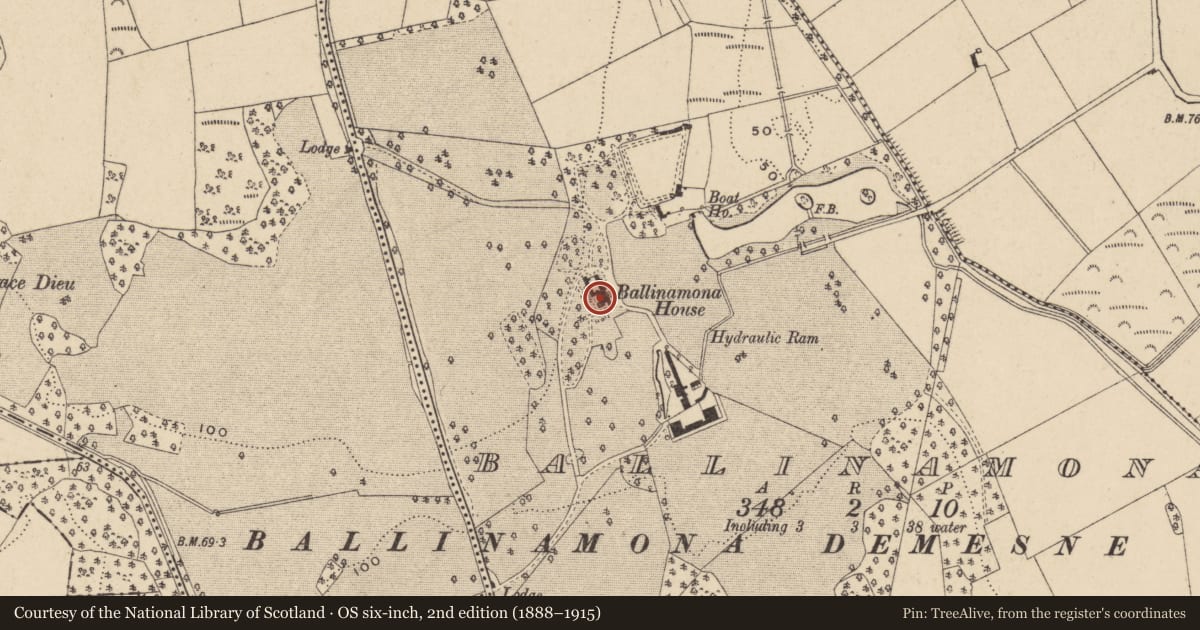
- First-edition OS map
- Ballinamona Ho.
- Latest-edition OS map
- Ballinamona House
- Coordinates
- 52.21503, -7.10825
- SMR number
- WA017-039----
Slide toward Today to fade the historical sheet and see the modern map underneath.
David Rumsey Map Collection, Stanford LibrariesUniversity Library, Vrije Universiteit AmsterdamDavid Rumsey Map Collection, Stanford LibrariesDavid Rumsey Map Collection, Stanford Libraries
4 historical maps cover this location, the earliest the 1790 map "Composite: Ireland." (David Rumsey Map Collection, Stanford Libraries).
Historical maps covering this location
- 1790 · Composite: Ireland. (David Rumsey Map Collection, Stanford Libraries)
- 1882 · Ireland (southern half). (David Rumsey Map Collection, Stanford Libraries)
- 1891 · Ireland 16 (David Rumsey Map Collection, Stanford Libraries)
- 1911 · Sheet 14, 1911 (University Library, Vrije Universiteit Amsterdam)
This record in the National Monuments Service's Historic Environment Viewer ↗
The National Monuments Service's description
Situated on a slight E-facing slope. Ballinamona House, a four bay, two storey over basement 18th century house that was rebuilt after a fire in 1894 is thought to have been built on the site of a castle that was built in 1488, but there is no documentation (Bence-Jones 1975, 17-18). A single wall in the basement (L c. 6m; T c. 1m) with a base-batter is thought to be from the castle.
Bence-Jones, M. (1975) Burke's guide to country house. Vol. 1, Ireland. Burke's Peerage Ltd. London.
Compiled by: Michael Moore
Date of upload/revision: 06 January 2011
Nearby in the register
- Deer parkunder 1 mi
- Structureunder 1 mi
- Fulacht fiaunder 1 mi
- Fulacht fiaunder 1 mi
Other entries of the same register within about three miles of this one, by straight line.