Sites and Monuments Record · Ireland
House - Neolithic
Marlfield, County Tipperary South, Ireland
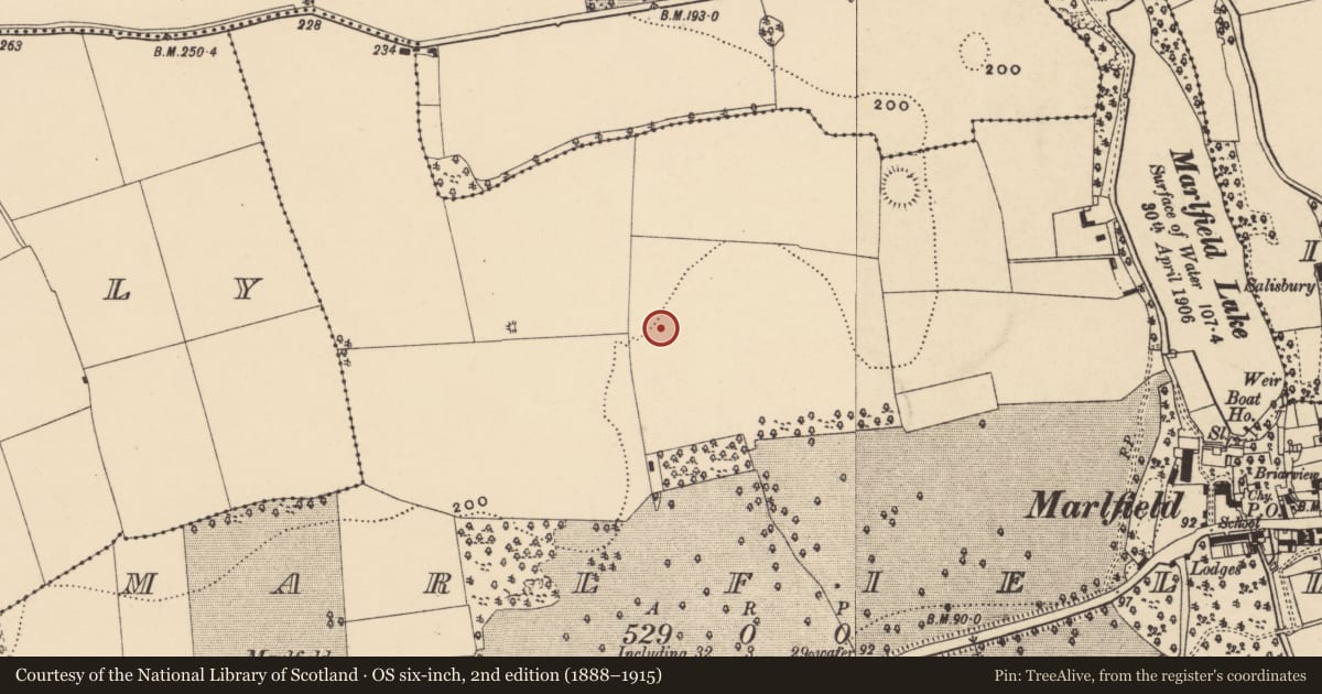
The record
- Townland
- Marlfield
- County
- Tipperary South
- Country
- Ireland
- First-edition OS map
- Not indicated
- Latest-edition OS map
- Not indicated
- Coordinates
- 52.35000, -7.75981
- SMR number
- TS082-104----
Slide toward Today to fade the historical sheet and see the modern map underneath.
David Rumsey Map Collection, Stanford LibrariesDavid Rumsey Map Collection, Stanford LibrariesDavid Rumsey Map Collection, Stanford LibrariesDavid Rumsey Map Collection, Stanford Libraries
4 historical maps cover this location, the earliest the 1790 map "Composite: Ireland." (David Rumsey Map Collection, Stanford Libraries).
Historical maps covering this location
- 1790 · Composite: Ireland. (David Rumsey Map Collection, Stanford Libraries)
- 1882 · Ireland (southern half). (David Rumsey Map Collection, Stanford Libraries)
- 1891 · Ireland 16 (David Rumsey Map Collection, Stanford Libraries)
- 1904 · Sheet 13. (David Rumsey Map Collection, Stanford Libraries)
This record in the National Monuments Service's Historic Environment Viewer ↗
The National Monuments Service's description
On the edge of a shallow depression, which appears to have been a lake or marsh, on a flat platform above the flood plain of the River Suir, which flows E-W c. 850m to the S. A Neolithic house (dims. c. 8.5m ENE-WSW x 8m NNW-SSE) was uncovered during archaeological testing in advance of a proposed development (Lennon 2007). The house was delimited by a foundation trench within which were set a series of stake-holes of squared upright posts. Each corner is defined by a large post-hole. Two other post-holes were associated with the house, one (diam. 0.2m) inside the eastern edge of the foundation trench and another (diam. 0.5m) outside the house. A possible internal slot trench (Wth 0.15m) was uncovered 0.2m S of the foundation trench. Finds included flint and chert waste flakes, cores and debitage, indicating that arrowheads were being produced at the site. This assemblage has been dated to the beginning of the Middle Neolithic period. Fragments of carinated Neolithic pottery were also recovered which appear to represent several vessels. A soil sample yielded grains of emmer wheat, some charcoal remnants from an oak species and a charred hazelnut shell. The latter was used to obtain a radiocarbon date, which calibrated dated to between 3377 and 3634 B.C.
Compiled by: Jean Farrelly
Date of upload: 07 June 2012
References
Lennon, A. M. 2007 Preliminary report on archaeological testing of Neolithic house site at Marlfield, Clonmel, Co. Tipperary. Unpublished report.
Nearby in the register
- Burial groundunder 1 mi
- Castle - ringworkunder 1 mi
- Ringfort - rathunder 1 mi
- Ringfort - rathunder 1 mi
Other entries of the same register within about three miles of this one, by straight line.