Sites and Monuments Record · Ireland
House - 17th century
Fethard, County Tipperary South, Ireland
The record
- Townland
- Fethard
- County
- Tipperary South
- Country
- Ireland
- First-edition OS map
- Indicated
- Latest-edition OS map
- Indicated
- Coordinates
- 52.46582, -7.69261
- SMR number
- TS070-040016-
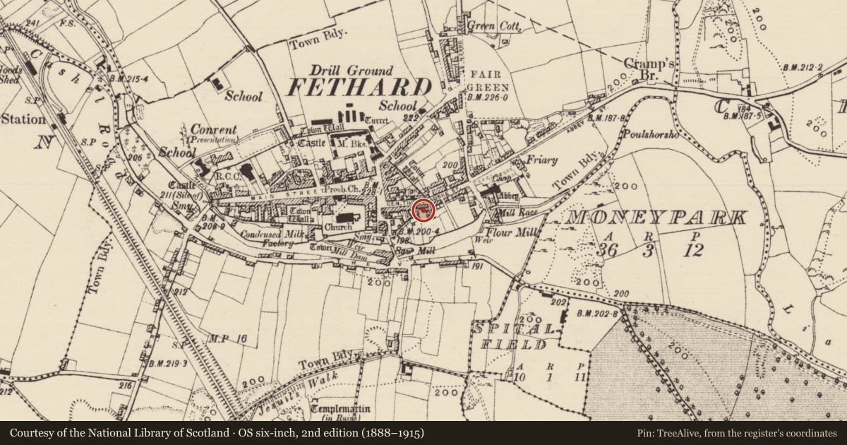
Slide toward Today to fade the historical sheet and see the modern map underneath.
David Rumsey Map Collection, Stanford LibrariesDavid Rumsey Map Collection, Stanford LibrariesDavid Rumsey Map Collection, Stanford LibrariesDavid Rumsey Map Collection, Stanford Libraries
4 historical maps cover this location, the earliest the 1790 map "Composite: Ireland." (David Rumsey Map Collection, Stanford Libraries).
Historical maps covering this location
- 1790 · Composite: Ireland. (David Rumsey Map Collection, Stanford Libraries)
- 1882 · Ireland (southern half). (David Rumsey Map Collection, Stanford Libraries)
- 1891 · Ireland 16 (David Rumsey Map Collection, Stanford Libraries)
- 1904 · Sheet 13. (David Rumsey Map Collection, Stanford Libraries)
This record in the National Monuments Service's Historic Environment Viewer ↗
The National Monuments Service's description
On the S side of Burke St. A five-bay two-storey house (L 12.25m) with a blank bay over the western doorway, and a rear projection (dims. 1.5m N-S x 4.65m E-W). There is a concave cornice under the eaves of the front façade and a stepped cornice of three brick courses to the rear. Craig and Garner (1975, 51) note that this building has ‘a steep-pitched roof and heavy stacks, but modernised façade’. O’Keeffe (1995, 69) suggests the building may be late 17th century in date. There is a pointed limestone chamfered doorway (Wth 0.97m) in the wall of the rear property boundary and two other similar chamfered doorways (TS070-040106- and TS070-040107-) in another wall further S of the property which runs parallel to and immediately N of the Clashawley River.
Compiled by: Jean Farrelly
Date of upload: 9 March 2015
References
Craig, M. and Garner, W. 1975 National heritage inventory of buildings of architectural, historic and artistic interest in County Tipperary - South Riding. A preliminary survey. An Foras Forbartha Teoranta. Unpublished.
O'Keeffe, T. 1995 Fethard, Co. Tipperary: an archaeological and historical survey. Unpublished report for The National Heritage Council.
Nearby in the register
- Buildingunder 1 mi
- House - 17th centuryunder 1 mi
- Buildingunder 1 mi
- Architectural featureunder 1 mi
Other entries of the same register within about three miles of this one, by straight line.